You are here: Home > Network List > IU - Global Seismograph Network (GSN - IRIS/USGS) Stations List
> Station CTAO Charters Towers, Australia > Earthquake Result Viewer
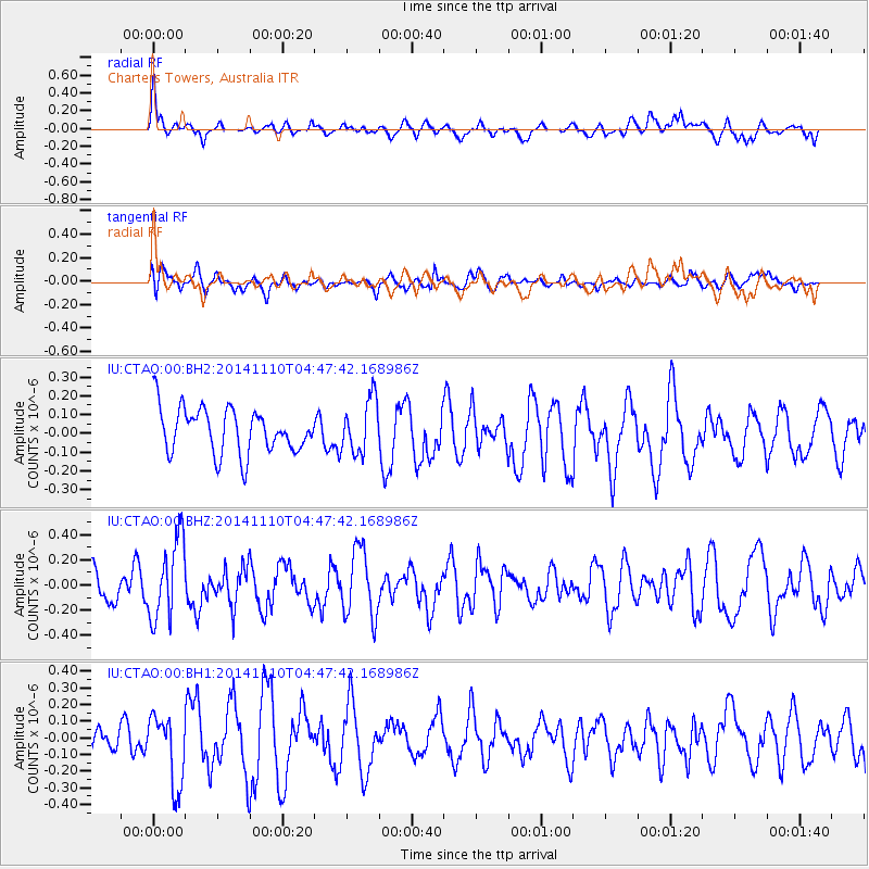
CTAO Charters Towers, Australia - Earthquake Result Viewer
*The percent match for this event was below the threshold and hence no stack was calculated.
| Earthquake location: |
Philippine Islands Region |
| Earthquake latitude/longitude: |
10.0/126.8 |
| Earthquake time(UTC): |
2014/11/10 (314) 04:41:21 GMT |
| Earthquake Depth: |
64 km |
| Earthquake Magnitude: |
5.5 MB |
| Earthquake Catalog/Contributor: |
NEIC PDE/NEIC COMCAT |
|
| Network: |
IU Global Seismograph Network (GSN - IRIS/USGS) |
| Station: |
CTAO Charters Towers, Australia |
| Lat/Lon: |
20.09 S/146.25 E |
| Elevation: |
357 m |
|
| Distance: |
35.5 deg |
| Az: |
147.477 deg |
| Baz: |
325.71 deg |
| Ray Param: |
$rayparam |
*The percent match for this event was below the threshold and hence was not used in the summary stack. |
|
| Radial Match: |
56.965485 % |
| Radial Bump: |
400 |
| Transverse Match: |
55.435215 % |
| Transverse Bump: |
400 |
| SOD ConfigId: |
815943 |
| Insert Time: |
2014-11-24 04:58:33.877 +0000 |
| GWidth: |
2.5 |
| Max Bumps: |
400 |
| Tol: |
0.001 |
|
Signal To Noise
| Channel | StoN | STA | LTA |
| IU:CTAO:00:BHZ:20141110T04:47:42.168986Z | 1.8736293 | 3.1810868E-7 | 1.6978207E-7 |
| IU:CTAO:00:BH1:20141110T04:47:42.168986Z | 1.9618273 | 2.061163E-7 | 1.0506343E-7 |
| IU:CTAO:00:BH2:20141110T04:47:42.168986Z | 1.2130573 | 1.4491562E-7 | 1.1946314E-7 |
| Arrivals |
| Ps | |
| PpPs | |
| PsPs/PpSs | |


