You are here: Home > Network List > IU - Global Seismograph Network (GSN - IRIS/USGS) Stations List
> Station JOHN Johnston Island, USA > Earthquake Result Viewer
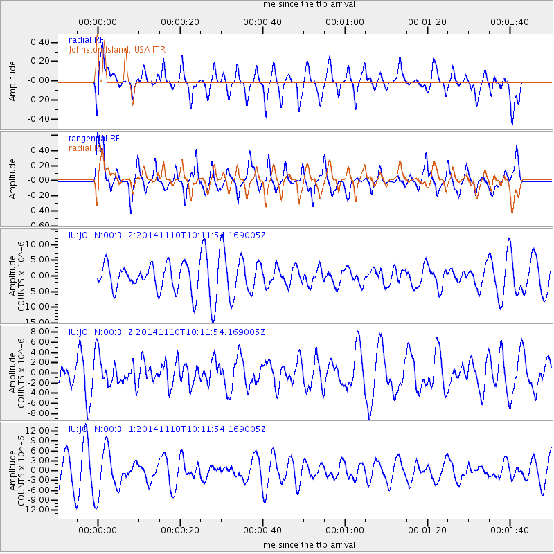
JOHN Johnston Island, USA - Earthquake Result Viewer
*The percent match for this event was below the threshold and hence no stack was calculated.
| Earthquake location: |
Southeast Of Loyalty Islands |
| Earthquake latitude/longitude: |
-22.8/171.4 |
| Earthquake time(UTC): |
2014/11/10 (314) 10:04:21 GMT |
| Earthquake Depth: |
10 km |
| Earthquake Magnitude: |
6.1 MWP |
| Earthquake Catalog/Contributor: |
NEIC PDE/NEIC COMCAT |
|
| Network: |
IU Global Seismograph Network (GSN - IRIS/USGS) |
| Station: |
JOHN Johnston Island, USA |
| Lat/Lon: |
16.73 N/169.53 W |
| Elevation: |
2.0 m |
|
| Distance: |
43.5 deg |
| Az: |
27.011 deg |
| Baz: |
205.942 deg |
| Ray Param: |
$rayparam |
*The percent match for this event was below the threshold and hence was not used in the summary stack. |
|
| Radial Match: |
67.4819 % |
| Radial Bump: |
400 |
| Transverse Match: |
63.667343 % |
| Transverse Bump: |
400 |
| SOD ConfigId: |
815943 |
| Insert Time: |
2014-11-24 10:14:09.010 +0000 |
| GWidth: |
2.5 |
| Max Bumps: |
400 |
| Tol: |
0.001 |
|
Signal To Noise
| Channel | StoN | STA | LTA |
| IU:JOHN:00:BHZ:20141110T10:11:54.169005Z | 1.1044908 | 3.1795196E-6 | 2.8787201E-6 |
| IU:JOHN:00:BH1:20141110T10:11:54.169005Z | 1.6967556 | 7.299689E-6 | 4.3021455E-6 |
| IU:JOHN:00:BH2:20141110T10:11:54.169005Z | 1.917972 | 7.7610775E-6 | 4.046502E-6 |
| Arrivals |
| Ps | |
| PpPs | |
| PsPs/PpSs | |


