You are here: Home > Network List > TA - USArray Transportable Network (new EarthScope stations) Stations List
> Station 121A Cookes Peak, Deming, NM, USA > Earthquake Result Viewer
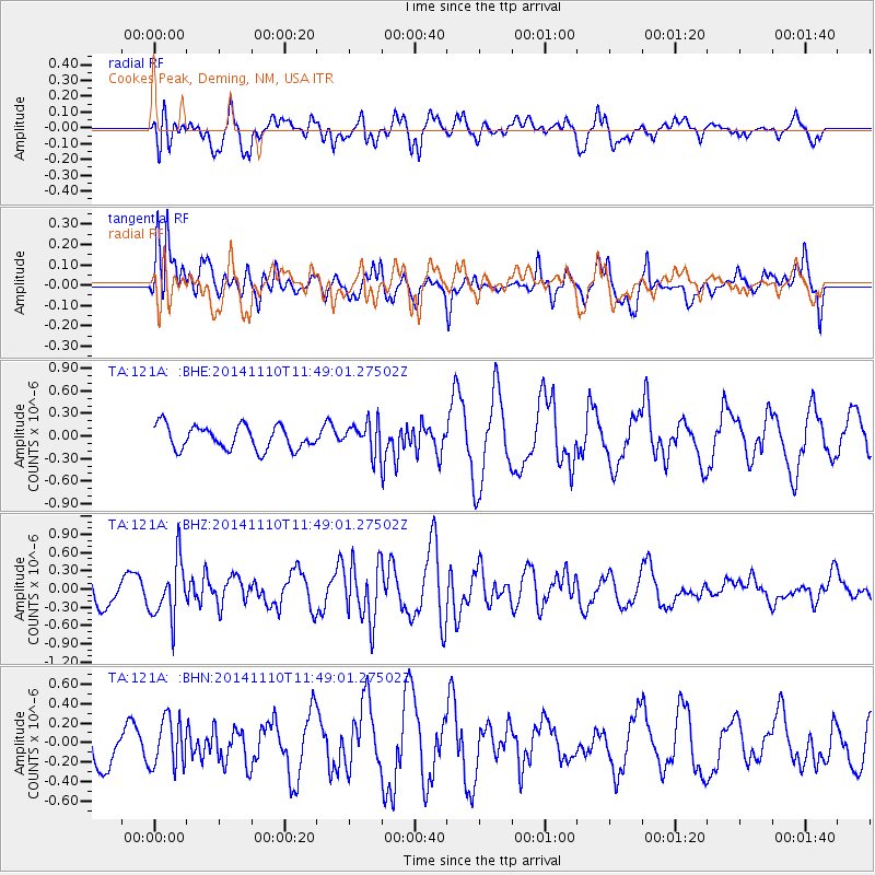
121A Cookes Peak, Deming, NM, USA - Earthquake Result Viewer
*The percent match for this event was below the threshold and hence no stack was calculated.
| Earthquake location: |
Chile-Bolivia Border Region |
| Earthquake latitude/longitude: |
-21.6/-68.5 |
| Earthquake time(UTC): |
2014/11/10 (314) 11:38:58 GMT |
| Earthquake Depth: |
104 km |
| Earthquake Magnitude: |
5.8 MB |
| Earthquake Catalog/Contributor: |
NEIC PDE/NEIC COMCAT |
|
| Network: |
TA USArray Transportable Network (new EarthScope stations) |
| Station: |
121A Cookes Peak, Deming, NM, USA |
| Lat/Lon: |
32.53 N/107.79 W |
| Elevation: |
1652 m |
|
| Distance: |
65.7 deg |
| Az: |
324.071 deg |
| Baz: |
139.739 deg |
| Ray Param: |
$rayparam |
*The percent match for this event was below the threshold and hence was not used in the summary stack. |
|
| Radial Match: |
40.13421 % |
| Radial Bump: |
400 |
| Transverse Match: |
52.118988 % |
| Transverse Bump: |
386 |
| SOD ConfigId: |
815943 |
| Insert Time: |
2014-11-24 12:05:31.853 +0000 |
| GWidth: |
2.5 |
| Max Bumps: |
400 |
| Tol: |
0.001 |
|
Signal To Noise
| Channel | StoN | STA | LTA |
| TA:121A: :BHZ:20141110T11:49:01.27502Z | 1.6928489 | 4.7169107E-7 | 2.7863743E-7 |
| TA:121A: :BHN:20141110T11:49:01.27502Z | 0.72876453 | 2.493256E-7 | 3.4212093E-7 |
| TA:121A: :BHE:20141110T11:49:01.27502Z | 1.2886801 | 2.017511E-7 | 1.565564E-7 |
| Arrivals |
| Ps | |
| PpPs | |
| PsPs/PpSs | |


