You are here: Home > Network List > TA - USArray Transportable Network (new EarthScope stations) Stations List
> Station O03E Paynes Creek, CA, USA > Earthquake Result Viewer
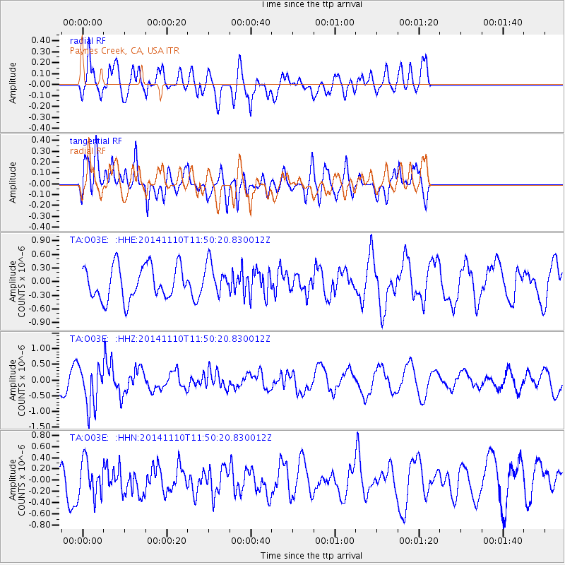
O03E Paynes Creek, CA, USA - Earthquake Result Viewer
*The percent match for this event was below the threshold and hence no stack was calculated.
| Earthquake location: |
Chile-Bolivia Border Region |
| Earthquake latitude/longitude: |
-21.6/-68.5 |
| Earthquake time(UTC): |
2014/11/10 (314) 11:38:58 GMT |
| Earthquake Depth: |
104 km |
| Earthquake Magnitude: |
5.8 MB |
| Earthquake Catalog/Contributor: |
NEIC PDE/NEIC COMCAT |
|
| Network: |
TA USArray Transportable Network (new EarthScope stations) |
| Station: |
O03E Paynes Creek, CA, USA |
| Lat/Lon: |
40.29 N/121.80 W |
| Elevation: |
967 m |
|
| Distance: |
79.1 deg |
| Az: |
321.363 deg |
| Baz: |
130.583 deg |
| Ray Param: |
$rayparam |
*The percent match for this event was below the threshold and hence was not used in the summary stack. |
|
| Radial Match: |
73.03366 % |
| Radial Bump: |
400 |
| Transverse Match: |
61.654392 % |
| Transverse Bump: |
400 |
| SOD ConfigId: |
815943 |
| Insert Time: |
2014-11-24 12:07:51.185 +0000 |
| GWidth: |
2.5 |
| Max Bumps: |
400 |
| Tol: |
0.001 |
|
Signal To Noise
| Channel | StoN | STA | LTA |
| TA:O03E: :HHZ:20141110T11:50:20.830012Z | 2.2620451 | 6.466634E-7 | 2.8587556E-7 |
| TA:O03E: :HHN:20141110T11:50:20.830012Z | 1.7343924 | 3.1544266E-7 | 1.8187502E-7 |
| TA:O03E: :HHE:20141110T11:50:20.830012Z | 0.9614574 | 3.5040088E-7 | 3.6444763E-7 |
| Arrivals |
| Ps | |
| PpPs | |
| PsPs/PpSs | |


