You are here: Home > Network List > TA - USArray Transportable Network (new EarthScope stations) Stations List
> Station V56A Mocksville, NC, USA > Earthquake Result Viewer
V56A Mocksville, NC, USA - Earthquake Result Viewer
*The percent match for this event was below the threshold and hence no stack was calculated.
| Earthquake location: |
Chile-Bolivia Border Region |
| Earthquake latitude/longitude: |
-21.6/-68.5 |
| Earthquake time(UTC): |
2014/11/10 (314) 11:38:58 GMT |
| Earthquake Depth: |
104 km |
| Earthquake Magnitude: |
5.8 MB |
| Earthquake Catalog/Contributor: |
NEIC PDE/NEIC COMCAT |
|
| Network: |
TA USArray Transportable Network (new EarthScope stations) |
| Station: |
V56A Mocksville, NC, USA |
| Lat/Lon: |
35.81 N/80.50 W |
| Elevation: |
237 m |
|
| Distance: |
58.3 deg |
| Az: |
348.561 deg |
| Baz: |
166.88 deg |
| Ray Param: |
$rayparam |
*The percent match for this event was below the threshold and hence was not used in the summary stack. |
|
| Radial Match: |
70.04196 % |
| Radial Bump: |
400 |
| Transverse Match: |
73.38649 % |
| Transverse Bump: |
400 |
| SOD ConfigId: |
815943 |
| Insert Time: |
2014-11-24 12:09:26.026 +0000 |
| GWidth: |
2.5 |
| Max Bumps: |
400 |
| Tol: |
0.001 |
|
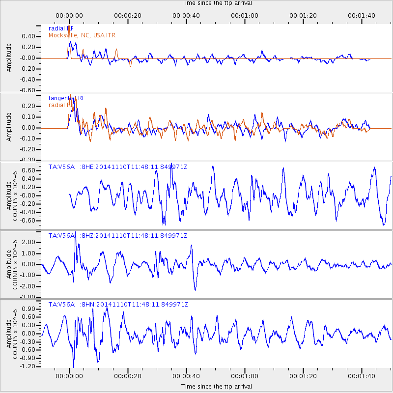
Signal To Noise
| Channel | StoN | STA | LTA |
| TA:V56A: :BHZ:20141110T11:48:11.849971Z | 2.8535447 | 1.1324576E-6 | 3.9685992E-7 |
| TA:V56A: :BHN:20141110T11:48:11.849971Z | 1.5361544 | 4.604499E-7 | 2.9974194E-7 |
| TA:V56A: :BHE:20141110T11:48:11.849971Z | 1.9719775 | 4.1350015E-7 | 2.0968807E-7 |
| Arrivals |
| Ps | |
| PpPs | |
| PsPs/PpSs | |


