You are here: Home > Network List > TA - USArray Transportable Network (new EarthScope stations) Stations List
> Station V61A Roper, NC, USA > Earthquake Result Viewer
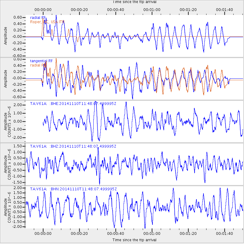
V61A Roper, NC, USA - Earthquake Result Viewer
*The percent match for this event was below the threshold and hence no stack was calculated.
| Earthquake location: |
Chile-Bolivia Border Region |
| Earthquake latitude/longitude: |
-21.6/-68.5 |
| Earthquake time(UTC): |
2014/11/10 (314) 11:38:58 GMT |
| Earthquake Depth: |
104 km |
| Earthquake Magnitude: |
5.8 MB |
| Earthquake Catalog/Contributor: |
NEIC PDE/NEIC COMCAT |
|
| Network: |
TA USArray Transportable Network (new EarthScope stations) |
| Station: |
V61A Roper, NC, USA |
| Lat/Lon: |
35.79 N/76.58 W |
| Elevation: |
4.0 m |
|
| Distance: |
57.6 deg |
| Az: |
352.247 deg |
| Baz: |
171.12 deg |
| Ray Param: |
$rayparam |
*The percent match for this event was below the threshold and hence was not used in the summary stack. |
|
| Radial Match: |
59.583828 % |
| Radial Bump: |
400 |
| Transverse Match: |
59.98709 % |
| Transverse Bump: |
400 |
| SOD ConfigId: |
815943 |
| Insert Time: |
2014-11-24 12:09:32.283 +0000 |
| GWidth: |
2.5 |
| Max Bumps: |
400 |
| Tol: |
0.001 |
|
Signal To Noise
| Channel | StoN | STA | LTA |
| TA:V61A: :BHZ:20141110T11:48:07.499995Z | 1.1259303 | 5.0124584E-7 | 4.451837E-7 |
| TA:V61A: :BHN:20141110T11:48:07.499995Z | 1.5150062 | 9.1791105E-7 | 6.058794E-7 |
| TA:V61A: :BHE:20141110T11:48:07.499995Z | 2.8121347 | 1.5502299E-6 | 5.5126446E-7 |
| Arrivals |
| Ps | |
| PpPs | |
| PsPs/PpSs | |


