You are here: Home > Network List > II - Global Seismograph Network (GSN - IRIS/IDA) Stations List
> Station WRAB Tennant Creek, NT, Australia > Earthquake Result Viewer
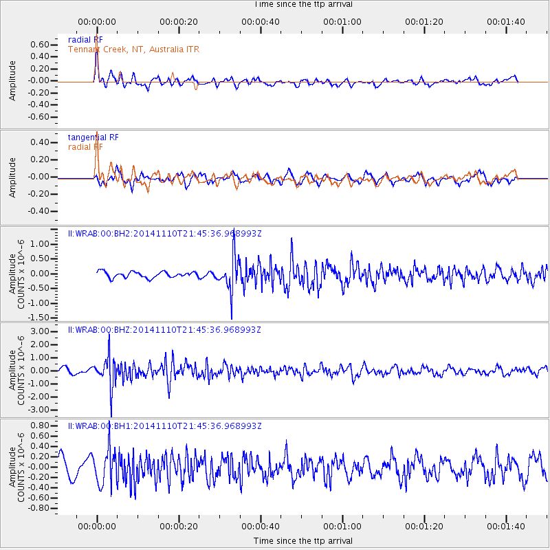
WRAB Tennant Creek, NT, Australia - Earthquake Result Viewer
*The percent match for this event was below the threshold and hence no stack was calculated.
| Earthquake location: |
Kermadec Islands, New Zealand |
| Earthquake latitude/longitude: |
-30.1/-177.7 |
| Earthquake time(UTC): |
2014/11/10 (314) 21:38:00 GMT |
| Earthquake Depth: |
28 km |
| Earthquake Magnitude: |
5.6 MWB |
| Earthquake Catalog/Contributor: |
NEIC PDE/NEIC COMCAT |
|
| Network: |
II Global Seismograph Network (GSN - IRIS/IDA) |
| Station: |
WRAB Tennant Creek, NT, Australia |
| Lat/Lon: |
19.93 S/134.36 E |
| Elevation: |
366 m |
|
| Distance: |
44.3 deg |
| Az: |
271.689 deg |
| Baz: |
112.931 deg |
| Ray Param: |
$rayparam |
*The percent match for this event was below the threshold and hence was not used in the summary stack. |
|
| Radial Match: |
67.51184 % |
| Radial Bump: |
400 |
| Transverse Match: |
65.88364 % |
| Transverse Bump: |
400 |
| SOD ConfigId: |
816305 |
| Insert Time: |
2014-11-24 21:54:36.866 +0000 |
| GWidth: |
2.5 |
| Max Bumps: |
400 |
| Tol: |
0.001 |
|
Signal To Noise
| Channel | StoN | STA | LTA |
| II:WRAB:00:BHZ:20141110T21:45:36.968993Z | 5.944856 | 1.1545525E-6 | 1.9421034E-7 |
| II:WRAB:00:BH1:20141110T21:45:36.968993Z | 1.966679 | 3.3790533E-7 | 1.718152E-7 |
| II:WRAB:00:BH2:20141110T21:45:36.968993Z | 5.8230486 | 5.800853E-7 | 9.961883E-8 |
| Arrivals |
| Ps | |
| PpPs | |
| PsPs/PpSs | |


