You are here: Home > Network List > IU - Global Seismograph Network (GSN - IRIS/USGS) Stations List
> Station JOHN Johnston Island, USA > Earthquake Result Viewer
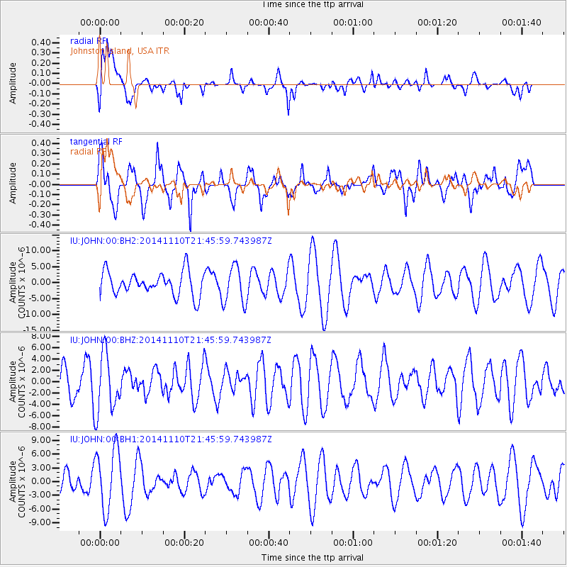
JOHN Johnston Island, USA - Earthquake Result Viewer
*The percent match for this event was below the threshold and hence no stack was calculated.
| Earthquake location: |
Kermadec Islands, New Zealand |
| Earthquake latitude/longitude: |
-30.1/-177.7 |
| Earthquake time(UTC): |
2014/11/10 (314) 21:38:00 GMT |
| Earthquake Depth: |
28 km |
| Earthquake Magnitude: |
5.6 MWB |
| Earthquake Catalog/Contributor: |
NEIC PDE/NEIC COMCAT |
|
| Network: |
IU Global Seismograph Network (GSN - IRIS/USGS) |
| Station: |
JOHN Johnston Island, USA |
| Lat/Lon: |
16.73 N/169.53 W |
| Elevation: |
2.0 m |
|
| Distance: |
47.2 deg |
| Az: |
10.727 deg |
| Baz: |
189.694 deg |
| Ray Param: |
$rayparam |
*The percent match for this event was below the threshold and hence was not used in the summary stack. |
|
| Radial Match: |
46.649166 % |
| Radial Bump: |
400 |
| Transverse Match: |
66.78959 % |
| Transverse Bump: |
400 |
| SOD ConfigId: |
816305 |
| Insert Time: |
2014-11-24 21:54:58.395 +0000 |
| GWidth: |
2.5 |
| Max Bumps: |
400 |
| Tol: |
0.001 |
|
Signal To Noise
| Channel | StoN | STA | LTA |
| IU:JOHN:00:BHZ:20141110T21:45:59.743987Z | 1.7172066 | 5.0573E-6 | 2.9450737E-6 |
| IU:JOHN:00:BH1:20141110T21:45:59.743987Z | 3.3615768 | 6.7950605E-6 | 2.0213909E-6 |
| IU:JOHN:00:BH2:20141110T21:45:59.743987Z | 1.6398804 | 6.0081493E-6 | 3.6637728E-6 |
| Arrivals |
| Ps | |
| PpPs | |
| PsPs/PpSs | |


