You are here: Home > Network List > TA - USArray Transportable Network (new EarthScope stations) Stations List
> Station J01E Myrtle Point, OR, USA > Earthquake Result Viewer
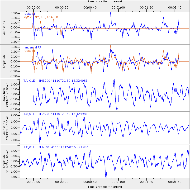
J01E Myrtle Point, OR, USA - Earthquake Result Viewer
*The percent match for this event was below the threshold and hence no stack was calculated.
| Earthquake location: |
Kermadec Islands, New Zealand |
| Earthquake latitude/longitude: |
-30.1/-177.7 |
| Earthquake time(UTC): |
2014/11/10 (314) 21:38:00 GMT |
| Earthquake Depth: |
28 km |
| Earthquake Magnitude: |
5.6 MWB |
| Earthquake Catalog/Contributor: |
NEIC PDE/NEIC COMCAT |
|
| Network: |
TA USArray Transportable Network (new EarthScope stations) |
| Station: |
J01E Myrtle Point, OR, USA |
| Lat/Lon: |
43.16 N/123.93 W |
| Elevation: |
128 m |
|
| Distance: |
88.0 deg |
| Az: |
36.211 deg |
| Baz: |
224.416 deg |
| Ray Param: |
$rayparam |
*The percent match for this event was below the threshold and hence was not used in the summary stack. |
|
| Radial Match: |
45.29214 % |
| Radial Bump: |
400 |
| Transverse Match: |
50.217415 % |
| Transverse Bump: |
400 |
| SOD ConfigId: |
816305 |
| Insert Time: |
2014-11-24 21:59:24.415 +0000 |
| GWidth: |
2.5 |
| Max Bumps: |
400 |
| Tol: |
0.001 |
|
Signal To Noise
| Channel | StoN | STA | LTA |
| TA:J01E: :BHZ:20141110T21:50:16.32498Z | 2.4249573 | 1.108124E-6 | 4.5696643E-7 |
| TA:J01E: :BHN:20141110T21:50:16.32498Z | 0.35038257 | 2.2629754E-7 | 6.4585845E-7 |
| TA:J01E: :BHE:20141110T21:50:16.32498Z | 0.76228654 | 4.1048267E-7 | 5.384887E-7 |
| Arrivals |
| Ps | |
| PpPs | |
| PsPs/PpSs | |


