You are here: Home > Network List > US - United States National Seismic Network Stations List
> Station HAWA Hanford, Washington, USA > Earthquake Result Viewer
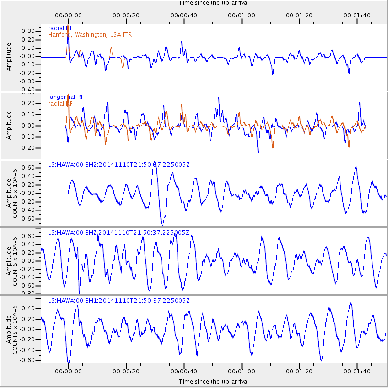
HAWA Hanford, Washington, USA - Earthquake Result Viewer
*The percent match for this event was below the threshold and hence no stack was calculated.
| Earthquake location: |
Kermadec Islands, New Zealand |
| Earthquake latitude/longitude: |
-30.1/-177.7 |
| Earthquake time(UTC): |
2014/11/10 (314) 21:38:00 GMT |
| Earthquake Depth: |
28 km |
| Earthquake Magnitude: |
5.6 MWB |
| Earthquake Catalog/Contributor: |
NEIC PDE/NEIC COMCAT |
|
| Network: |
US United States National Seismic Network |
| Station: |
HAWA Hanford, Washington, USA |
| Lat/Lon: |
46.39 N/119.53 W |
| Elevation: |
364 m |
|
| Distance: |
92.5 deg |
| Az: |
36.068 deg |
| Baz: |
227.506 deg |
| Ray Param: |
$rayparam |
*The percent match for this event was below the threshold and hence was not used in the summary stack. |
|
| Radial Match: |
69.36434 % |
| Radial Bump: |
400 |
| Transverse Match: |
62.31904 % |
| Transverse Bump: |
400 |
| SOD ConfigId: |
816305 |
| Insert Time: |
2014-11-24 22:00:30.790 +0000 |
| GWidth: |
2.5 |
| Max Bumps: |
400 |
| Tol: |
0.001 |
|
Signal To Noise
| Channel | StoN | STA | LTA |
| US:HAWA:00:BHZ:20141110T21:50:37.225005Z | 0.998095 | 3.9361416E-7 | 3.9436543E-7 |
| US:HAWA:00:BH1:20141110T21:50:37.225005Z | 1.490447 | 3.6763566E-7 | 2.4666136E-7 |
| US:HAWA:00:BH2:20141110T21:50:37.225005Z | 3.5437374 | 5.280384E-7 | 1.4900607E-7 |
| Arrivals |
| Ps | |
| PpPs | |
| PsPs/PpSs | |


