You are here: Home > Network List > TA - USArray Transportable Network (new EarthScope stations) Stations List
> Station G03D McMinnville, OR, USA > Earthquake Result Viewer
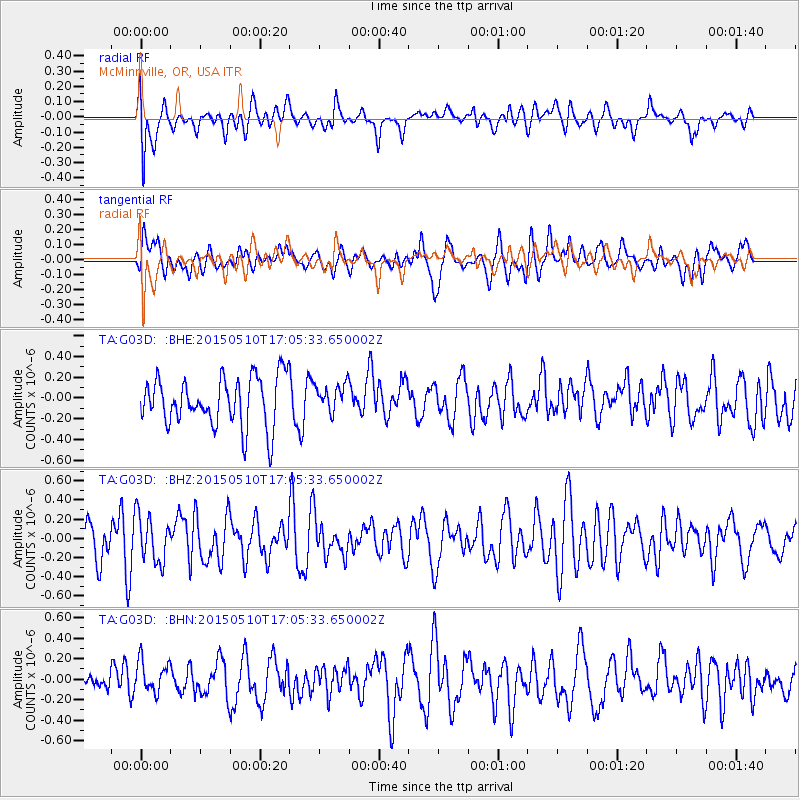
G03D McMinnville, OR, USA - Earthquake Result Viewer
*The percent match for this event was below the threshold and hence no stack was calculated.
| Earthquake location: |
Southeast Of Honshu, Japan |
| Earthquake latitude/longitude: |
31.2/141.9 |
| Earthquake time(UTC): |
2015/05/10 (130) 16:54:43 GMT |
| Earthquake Depth: |
17 km |
| Earthquake Magnitude: |
5.2 MW |
| Earthquake Catalog/Contributor: |
ISC/ISC |
|
| Network: |
TA USArray Transportable Network (new EarthScope stations) |
| Station: |
G03D McMinnville, OR, USA |
| Lat/Lon: |
45.21 N/123.26 W |
| Elevation: |
222 m |
|
| Distance: |
71.7 deg |
| Az: |
47.89 deg |
| Baz: |
295.918 deg |
| Ray Param: |
$rayparam |
*The percent match for this event was below the threshold and hence was not used in the summary stack. |
|
| Radial Match: |
44.69869 % |
| Radial Bump: |
400 |
| Transverse Match: |
49.07194 % |
| Transverse Bump: |
400 |
| SOD ConfigId: |
7422571 |
| Insert Time: |
2019-04-18 19:11:42.051 +0000 |
| GWidth: |
2.5 |
| Max Bumps: |
400 |
| Tol: |
0.001 |
|
Signal To Noise
| Channel | StoN | STA | LTA |
| TA:G03D: :BHZ:20150510T17:05:33.650002Z | 1.5404147 | 2.4328642E-7 | 1.5793567E-7 |
| TA:G03D: :BHN:20150510T17:05:33.650002Z | 1.5252358 | 1.6431696E-7 | 1.0773216E-7 |
| TA:G03D: :BHE:20150510T17:05:33.650002Z | 0.57338256 | 1.3557293E-7 | 2.3644412E-7 |
| Arrivals |
| Ps | |
| PpPs | |
| PsPs/PpSs | |


