You are here: Home > Network List > US - United States National Seismic Network Stations List
> Station LAO LASA Array, Montana, USA > Earthquake Result Viewer
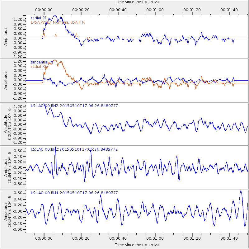
LAO LASA Array, Montana, USA - Earthquake Result Viewer
*The percent match for this event was below the threshold and hence no stack was calculated.
| Earthquake location: |
Southeast Of Honshu, Japan |
| Earthquake latitude/longitude: |
31.2/141.9 |
| Earthquake time(UTC): |
2015/05/10 (130) 16:54:43 GMT |
| Earthquake Depth: |
17 km |
| Earthquake Magnitude: |
5.2 MW |
| Earthquake Catalog/Contributor: |
ISC/ISC |
|
| Network: |
US United States National Seismic Network |
| Station: |
LAO LASA Array, Montana, USA |
| Lat/Lon: |
46.69 N/106.22 W |
| Elevation: |
902 m |
|
| Distance: |
81.1 deg |
| Az: |
40.295 deg |
| Baz: |
306.379 deg |
| Ray Param: |
$rayparam |
*The percent match for this event was below the threshold and hence was not used in the summary stack. |
|
| Radial Match: |
40.128353 % |
| Radial Bump: |
400 |
| Transverse Match: |
53.341297 % |
| Transverse Bump: |
400 |
| SOD ConfigId: |
7422571 |
| Insert Time: |
2019-04-18 19:12:27.546 +0000 |
| GWidth: |
2.5 |
| Max Bumps: |
400 |
| Tol: |
0.001 |
|
Signal To Noise
| Channel | StoN | STA | LTA |
| US:LAO:00:BHZ:20150510T17:06:26.848977Z | 1.0382444 | 1.3208754E-7 | 1.2722201E-7 |
| US:LAO:00:BH1:20150510T17:06:26.848977Z | 1.4399366 | 2.400935E-7 | 1.6673893E-7 |
| US:LAO:00:BH2:20150510T17:06:26.848977Z | 1.380787 | 6.1750933E-7 | 4.472155E-7 |
| Arrivals |
| Ps | |
| PpPs | |
| PsPs/PpSs | |


