You are here: Home > Network List > US - United States National Seismic Network Stations List
> Station CBKS Cedar Bluff, Kansas, USA > Earthquake Result Viewer
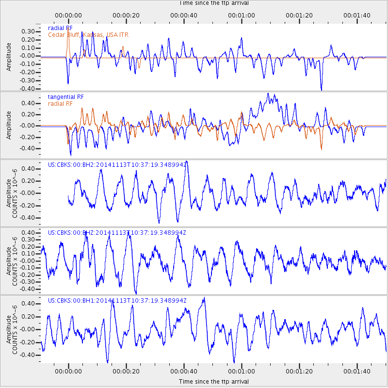
CBKS Cedar Bluff, Kansas, USA - Earthquake Result Viewer
*The percent match for this event was below the threshold and hence no stack was calculated.
| Earthquake location: |
Fiji Islands Region |
| Earthquake latitude/longitude: |
-15.2/173.1 |
| Earthquake time(UTC): |
2014/11/13 (317) 10:24:18 GMT |
| Earthquake Depth: |
10 km |
| Earthquake Magnitude: |
5.7 MB |
| Earthquake Catalog/Contributor: |
NEIC PDE/NEIC COMCAT |
|
| Network: |
US United States National Seismic Network |
| Station: |
CBKS Cedar Bluff, Kansas, USA |
| Lat/Lon: |
38.81 N/99.74 W |
| Elevation: |
677 m |
|
| Distance: |
97.2 deg |
| Az: |
51.863 deg |
| Baz: |
256.449 deg |
| Ray Param: |
$rayparam |
*The percent match for this event was below the threshold and hence was not used in the summary stack. |
|
| Radial Match: |
50.231567 % |
| Radial Bump: |
400 |
| Transverse Match: |
40.32332 % |
| Transverse Bump: |
400 |
| SOD ConfigId: |
816305 |
| Insert Time: |
2014-11-27 10:46:14.348 +0000 |
| GWidth: |
2.5 |
| Max Bumps: |
400 |
| Tol: |
0.001 |
|
Signal To Noise
| Channel | StoN | STA | LTA |
| US:CBKS:00:BHZ:20141113T10:37:19.348994Z | 0.9706369 | 1.4433084E-7 | 1.4869705E-7 |
| US:CBKS:00:BH1:20141113T10:37:19.348994Z | 0.44314688 | 1.5219916E-7 | 3.434508E-7 |
| US:CBKS:00:BH2:20141113T10:37:19.348994Z | 1.2514397 | 2.2363389E-7 | 1.7870128E-7 |
| Arrivals |
| Ps | |
| PpPs | |
| PsPs/PpSs | |


