You are here: Home > Network List > US - United States National Seismic Network Stations List
> Station EGMT Eagleton, Montana, USA > Earthquake Result Viewer
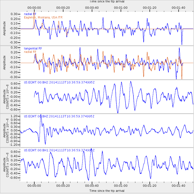
EGMT Eagleton, Montana, USA - Earthquake Result Viewer
*The percent match for this event was below the threshold and hence no stack was calculated.
| Earthquake location: |
Fiji Islands Region |
| Earthquake latitude/longitude: |
-15.2/173.1 |
| Earthquake time(UTC): |
2014/11/13 (317) 10:24:18 GMT |
| Earthquake Depth: |
10 km |
| Earthquake Magnitude: |
5.7 MB |
| Earthquake Catalog/Contributor: |
NEIC PDE/NEIC COMCAT |
|
| Network: |
US United States National Seismic Network |
| Station: |
EGMT Eagleton, Montana, USA |
| Lat/Lon: |
48.02 N/109.75 W |
| Elevation: |
1055 m |
|
| Distance: |
92.8 deg |
| Az: |
40.949 deg |
| Baz: |
250.514 deg |
| Ray Param: |
$rayparam |
*The percent match for this event was below the threshold and hence was not used in the summary stack. |
|
| Radial Match: |
58.664997 % |
| Radial Bump: |
400 |
| Transverse Match: |
46.12064 % |
| Transverse Bump: |
388 |
| SOD ConfigId: |
816305 |
| Insert Time: |
2014-11-27 10:46:24.078 +0000 |
| GWidth: |
2.5 |
| Max Bumps: |
400 |
| Tol: |
0.001 |
|
Signal To Noise
| Channel | StoN | STA | LTA |
| US:EGMT:00:BHZ:20141113T10:36:59.374995Z | 5.3359995 | 5.5737115E-7 | 1.0445487E-7 |
| US:EGMT:00:BH1:20141113T10:36:59.374995Z | 0.46770588 | 1.105212E-7 | 2.3630493E-7 |
| US:EGMT:00:BH2:20141113T10:36:59.374995Z | 0.7700841 | 1.2013534E-7 | 1.5600288E-7 |
| Arrivals |
| Ps | |
| PpPs | |
| PsPs/PpSs | |


