You are here: Home > Network List > WY - Yellowstone Wyoming Seismic Network Stations List
> Station YHH Holmes Hill, YNP, WY, USA > Earthquake Result Viewer
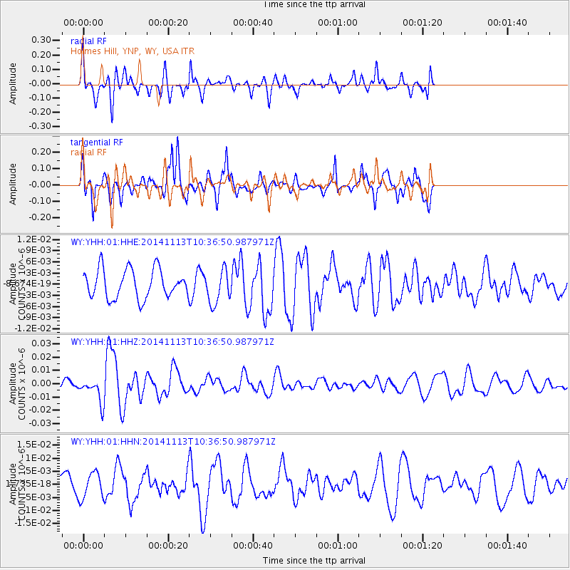
YHH Holmes Hill, YNP, WY, USA - Earthquake Result Viewer
*The percent match for this event was below the threshold and hence no stack was calculated.
| Earthquake location: |
Fiji Islands Region |
| Earthquake latitude/longitude: |
-15.2/173.1 |
| Earthquake time(UTC): |
2014/11/13 (317) 10:24:18 GMT |
| Earthquake Depth: |
10 km |
| Earthquake Magnitude: |
5.7 MB |
| Earthquake Catalog/Contributor: |
NEIC PDE/NEIC COMCAT |
|
| Network: |
WY Yellowstone Wyoming Seismic Network |
| Station: |
YHH Holmes Hill, YNP, WY, USA |
| Lat/Lon: |
44.79 N/110.85 W |
| Elevation: |
2717 m |
|
| Distance: |
91.0 deg |
| Az: |
43.735 deg |
| Baz: |
249.63 deg |
| Ray Param: |
$rayparam |
*The percent match for this event was below the threshold and hence was not used in the summary stack. |
|
| Radial Match: |
51.79514 % |
| Radial Bump: |
362 |
| Transverse Match: |
64.08712 % |
| Transverse Bump: |
345 |
| SOD ConfigId: |
816305 |
| Insert Time: |
2014-11-27 10:49:21.707 +0000 |
| GWidth: |
2.5 |
| Max Bumps: |
400 |
| Tol: |
0.001 |
|
Signal To Noise
| Channel | StoN | STA | LTA |
| WY:YHH:01:HHZ:20141113T10:36:50.987971Z | 2.0953915 | 9.4594785E-9 | 4.5144204E-9 |
| WY:YHH:01:HHN:20141113T10:36:50.987971Z | 1.1054189 | 4.946438E-9 | 4.4747184E-9 |
| WY:YHH:01:HHE:20141113T10:36:50.987971Z | 1.194668 | 4.6076716E-9 | 3.8568637E-9 |
| Arrivals |
| Ps | |
| PpPs | |
| PsPs/PpSs | |


