You are here: Home > Network List > UW - Pacific Northwest Regional Seismic Network Stations List
> Station LEBA Lebam, WA, USA > Earthquake Result Viewer
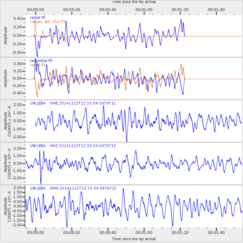
LEBA Lebam, WA, USA - Earthquake Result Viewer
*The percent match for this event was below the threshold and hence no stack was calculated.
| Earthquake location: |
Vanuatu Islands |
| Earthquake latitude/longitude: |
-18.5/169.1 |
| Earthquake time(UTC): |
2014/11/13 (317) 12:21:07 GMT |
| Earthquake Depth: |
218 km |
| Earthquake Magnitude: |
5.5 MB |
| Earthquake Catalog/Contributor: |
NEIC PDE/NEIC COMCAT |
|
| Network: |
UW Pacific Northwest Regional Seismic Network |
| Station: |
LEBA Lebam, WA, USA |
| Lat/Lon: |
46.55 N/123.56 W |
| Elevation: |
73 m |
|
| Distance: |
88.6 deg |
| Az: |
39.588 deg |
| Baz: |
241.188 deg |
| Ray Param: |
$rayparam |
*The percent match for this event was below the threshold and hence was not used in the summary stack. |
|
| Radial Match: |
44.582413 % |
| Radial Bump: |
400 |
| Transverse Match: |
57.557266 % |
| Transverse Bump: |
400 |
| SOD ConfigId: |
816828 |
| Insert Time: |
2014-11-27 12:38:37.802 +0000 |
| GWidth: |
2.5 |
| Max Bumps: |
400 |
| Tol: |
0.001 |
|
Signal To Noise
| Channel | StoN | STA | LTA |
| UW:LEBA: :HHZ:20141113T12:33:04.097971Z | 2.1139069 | 1.0075586E-6 | 4.766334E-7 |
| UW:LEBA: :HHN:20141113T12:33:04.097971Z | 0.7354053 | 6.9900716E-7 | 9.50506E-7 |
| UW:LEBA: :HHE:20141113T12:33:04.097971Z | 1.1310103 | 6.696523E-7 | 5.920833E-7 |
| Arrivals |
| Ps | |
| PpPs | |
| PsPs/PpSs | |


