You are here: Home > Network List > GS - US Geological Survey Networks Stations List
> Station DEC07 Decatur Surface Seismic Site, Decatur, IL, USA > Earthquake Result Viewer
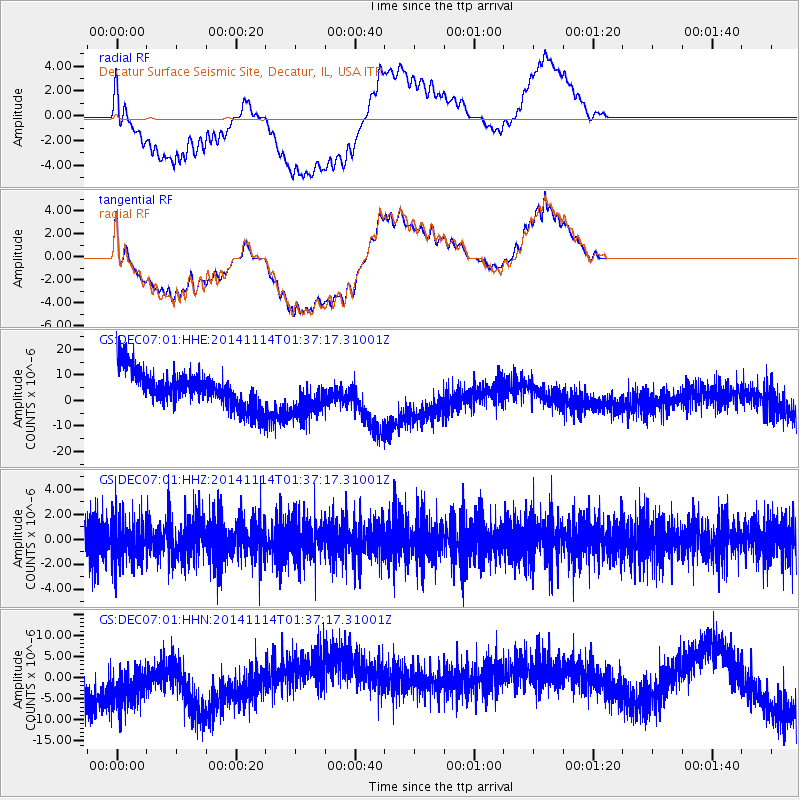
DEC07 Decatur Surface Seismic Site, Decatur, IL, USA - Earthquake Result Viewer
*The percent match for this event was below the threshold and hence no stack was calculated.
| Earthquake location: |
Lake Issyk-Kul Region |
| Earthquake latitude/longitude: |
42.1/77.3 |
| Earthquake time(UTC): |
2014/11/14 (318) 01:24:15 GMT |
| Earthquake Depth: |
10 km |
| Earthquake Magnitude: |
5.5 MB, 5.2 MWB |
| Earthquake Catalog/Contributor: |
NEIC PDE/NEIC COMCAT |
|
| Network: |
GS US Geological Survey Networks |
| Station: |
DEC07 Decatur Surface Seismic Site, Decatur, IL, USA |
| Lat/Lon: |
39.86 N/88.90 W |
| Elevation: |
212 m |
|
| Distance: |
97.4 deg |
| Az: |
349.302 deg |
| Baz: |
10.34 deg |
| Ray Param: |
$rayparam |
*The percent match for this event was below the threshold and hence was not used in the summary stack. |
|
| Radial Match: |
27.334135 % |
| Radial Bump: |
400 |
| Transverse Match: |
27.894342 % |
| Transverse Bump: |
400 |
| SOD ConfigId: |
816828 |
| Insert Time: |
2014-11-28 01:34:57.930 +0000 |
| GWidth: |
2.5 |
| Max Bumps: |
400 |
| Tol: |
0.001 |
|
Signal To Noise
| Channel | StoN | STA | LTA |
| GS:DEC07:01:HHZ:20141114T01:37:17.31001Z | 0.9987516 | 1.7368839E-6 | 1.7390548E-6 |
| GS:DEC07:01:HHN:20141114T01:37:17.31001Z | 1.3725284 | 7.504541E-6 | 5.467676E-6 |
| GS:DEC07:01:HHE:20141114T01:37:17.31001Z | 1.2369962 | 8.63485E-6 | 6.9804983E-6 |
| Arrivals |
| Ps | |
| PpPs | |
| PsPs/PpSs | |


