You are here: Home > Network List > TA - USArray Transportable Network (new EarthScope stations) Stations List
> Station G59A Clarenceville, QC, USA > Earthquake Result Viewer
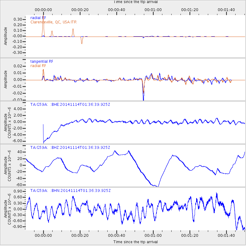
G59A Clarenceville, QC, USA - Earthquake Result Viewer
*The percent match for this event was below the threshold and hence no stack was calculated.
| Earthquake location: |
Lake Issyk-Kul Region |
| Earthquake latitude/longitude: |
42.1/77.3 |
| Earthquake time(UTC): |
2014/11/14 (318) 01:24:15 GMT |
| Earthquake Depth: |
10 km |
| Earthquake Magnitude: |
5.5 MB, 5.2 MWB |
| Earthquake Catalog/Contributor: |
NEIC PDE/NEIC COMCAT |
|
| Network: |
TA USArray Transportable Network (new EarthScope stations) |
| Station: |
G59A Clarenceville, QC, USA |
| Lat/Lon: |
45.08 N/73.18 W |
| Elevation: |
36 m |
|
| Distance: |
89.3 deg |
| Az: |
339.544 deg |
| Baz: |
21.536 deg |
| Ray Param: |
$rayparam |
*The percent match for this event was below the threshold and hence was not used in the summary stack. |
|
| Radial Match: |
78.0835 % |
| Radial Bump: |
400 |
| Transverse Match: |
73.94019 % |
| Transverse Bump: |
400 |
| SOD ConfigId: |
816828 |
| Insert Time: |
2014-11-28 01:41:29.773 +0000 |
| GWidth: |
2.5 |
| Max Bumps: |
400 |
| Tol: |
0.001 |
|
Signal To Noise
| Channel | StoN | STA | LTA |
| TA:G59A: :BHZ:20141114T01:36:39.925Z | 0.4938271 | 8.271057E-6 | 1.6748892E-5 |
| TA:G59A: :BHN:20141114T01:36:39.925Z | 0.5555441 | 2.4469918E-7 | 4.404676E-7 |
| TA:G59A: :BHE:20141114T01:36:39.925Z | 0.84013885 | 1.7498049E-6 | 2.082757E-6 |
| Arrivals |
| Ps | |
| PpPs | |
| PsPs/PpSs | |


