You are here: Home > Network List > TA - USArray Transportable Network (new EarthScope stations) Stations List
> Station A21K Barrow, AK, USA > Earthquake Result Viewer
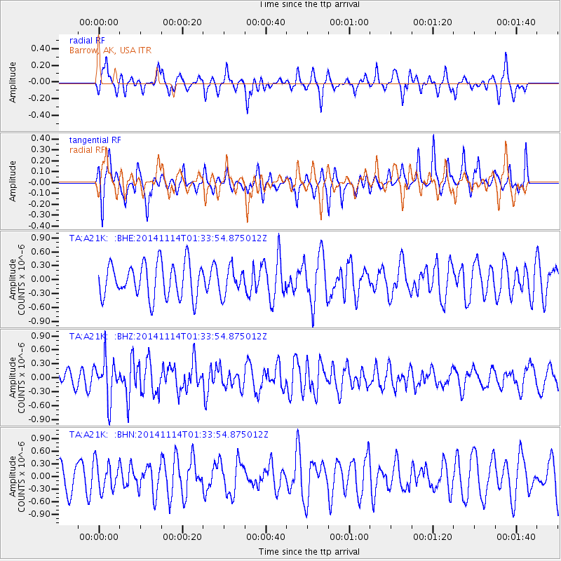
A21K Barrow, AK, USA - Earthquake Result Viewer
*The percent match for this event was below the threshold and hence no stack was calculated.
| Earthquake location: |
Lake Issyk-Kul Region |
| Earthquake latitude/longitude: |
42.1/77.3 |
| Earthquake time(UTC): |
2014/11/14 (318) 01:24:15 GMT |
| Earthquake Depth: |
10 km |
| Earthquake Magnitude: |
5.5 MB, 5.2 MWB |
| Earthquake Catalog/Contributor: |
NEIC PDE/NEIC COMCAT |
|
| Network: |
TA USArray Transportable Network (new EarthScope stations) |
| Station: |
A21K Barrow, AK, USA |
| Lat/Lon: |
71.32 N/156.62 W |
| Elevation: |
577 m |
|
| Distance: |
60.6 deg |
| Az: |
17.383 deg |
| Baz: |
316.365 deg |
| Ray Param: |
$rayparam |
*The percent match for this event was below the threshold and hence was not used in the summary stack. |
|
| Radial Match: |
60.777187 % |
| Radial Bump: |
400 |
| Transverse Match: |
51.416447 % |
| Transverse Bump: |
321 |
| SOD ConfigId: |
816828 |
| Insert Time: |
2014-11-28 01:43:28.263 +0000 |
| GWidth: |
2.5 |
| Max Bumps: |
400 |
| Tol: |
0.001 |
|
Signal To Noise
| Channel | StoN | STA | LTA |
| TA:A21K: :BHZ:20141114T01:33:54.875012Z | 1.7543356 | 4.2586137E-7 | 2.4274797E-7 |
| TA:A21K: :BHN:20141114T01:33:54.875012Z | 1.4174279 | 3.2547058E-7 | 2.2962055E-7 |
| TA:A21K: :BHE:20141114T01:33:54.875012Z | 0.7883511 | 2.8980025E-7 | 3.6760304E-7 |
| Arrivals |
| Ps | |
| PpPs | |
| PsPs/PpSs | |


