You are here: Home > Network List > CI - Caltech Regional Seismic Network Stations List
> Station MPP McPhearson Peak > Earthquake Result Viewer
MPP McPhearson Peak - Earthquake Result Viewer
*The percent match for this event was below the threshold and hence no stack was calculated.
| Earthquake location: |
Southeast Of Honshu, Japan |
| Earthquake latitude/longitude: |
31.2/142.4 |
| Earthquake time(UTC): |
2015/05/10 (130) 21:25:46 GMT |
| Earthquake Depth: |
18 km |
| Earthquake Magnitude: |
5.6 MB |
| Earthquake Catalog/Contributor: |
NEIC PDE/NEIC COMCAT |
|
| Network: |
CI Caltech Regional Seismic Network |
| Station: |
MPP McPhearson Peak |
| Lat/Lon: |
34.89 N/119.81 W |
| Elevation: |
1739 m |
|
| Distance: |
78.6 deg |
| Az: |
56.193 deg |
| Baz: |
300.036 deg |
| Ray Param: |
$rayparam |
*The percent match for this event was below the threshold and hence was not used in the summary stack. |
|
| Radial Match: |
72.87985 % |
| Radial Bump: |
400 |
| Transverse Match: |
40.496784 % |
| Transverse Bump: |
400 |
| SOD ConfigId: |
7422571 |
| Insert Time: |
2019-04-18 19:16:24.153 +0000 |
| GWidth: |
2.5 |
| Max Bumps: |
400 |
| Tol: |
0.001 |
|
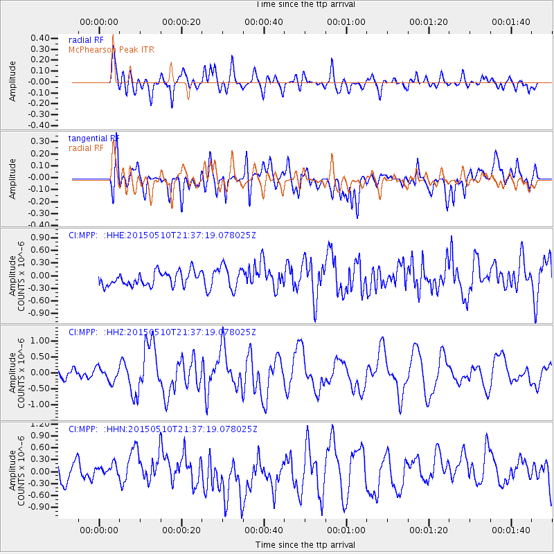
Signal To Noise
| Channel | StoN | STA | LTA |
| CI:MPP: :HHZ:20150510T21:37:19.078025Z | 1.3040677 | 2.1940522E-7 | 1.682468E-7 |
| CI:MPP: :HHN:20150510T21:37:19.078025Z | 1.0755029 | 4.101209E-7 | 3.8132941E-7 |
| CI:MPP: :HHE:20150510T21:37:19.078025Z | 2.0016115 | 2.926535E-7 | 1.4620895E-7 |
| Arrivals |
| Ps | |
| PpPs | |
| PsPs/PpSs | |


