You are here: Home > Network List > CI - Caltech Regional Seismic Network Stations List
> Station BAR Barrett, Tecate, CA, USA > Earthquake Result Viewer
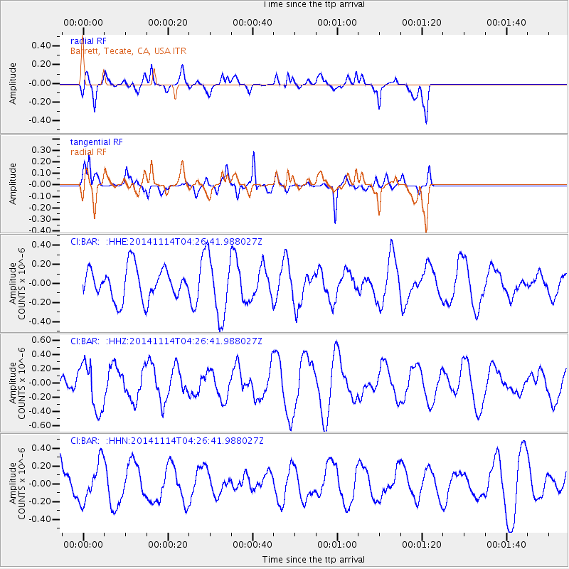
BAR Barrett, Tecate, CA, USA - Earthquake Result Viewer
*The percent match for this event was below the threshold and hence no stack was calculated.
| Earthquake location: |
Kuril Islands |
| Earthquake latitude/longitude: |
45.2/150.9 |
| Earthquake time(UTC): |
2014/11/14 (318) 04:16:07 GMT |
| Earthquake Depth: |
18 km |
| Earthquake Magnitude: |
5.7 MB |
| Earthquake Catalog/Contributor: |
NEIC PDE/NEIC COMCAT |
|
| Network: |
CI Caltech Regional Seismic Network |
| Station: |
BAR Barrett, Tecate, CA, USA |
| Lat/Lon: |
32.68 N/116.67 W |
| Elevation: |
521 m |
|
| Distance: |
69.2 deg |
| Az: |
64.342 deg |
| Baz: |
310.933 deg |
| Ray Param: |
$rayparam |
*The percent match for this event was below the threshold and hence was not used in the summary stack. |
|
| Radial Match: |
65.12999 % |
| Radial Bump: |
400 |
| Transverse Match: |
70.820404 % |
| Transverse Bump: |
284 |
| SOD ConfigId: |
817051 |
| Insert Time: |
2014-11-28 04:25:49.703 +0000 |
| GWidth: |
2.5 |
| Max Bumps: |
400 |
| Tol: |
0.001 |
|
Signal To Noise
| Channel | StoN | STA | LTA |
| CI:BAR: :HHZ:20141114T04:26:41.988027Z | 1.5044281 | 3.3696324E-7 | 2.2398095E-7 |
| CI:BAR: :HHN:20141114T04:26:41.988027Z | 1.5225246 | 2.2635581E-7 | 1.4867136E-7 |
| CI:BAR: :HHE:20141114T04:26:41.988027Z | 1.9729363 | 3.2109418E-7 | 1.627494E-7 |
| Arrivals |
| Ps | |
| PpPs | |
| PsPs/PpSs | |


