You are here: Home > Network List > TA - USArray Transportable Network (new EarthScope stations) Stations List
> Station MDND Maddock, ND, USA > Earthquake Result Viewer
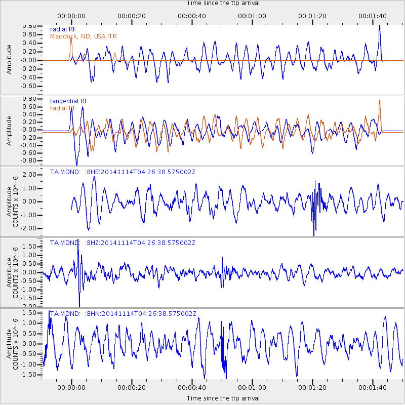
MDND Maddock, ND, USA - Earthquake Result Viewer
*The percent match for this event was below the threshold and hence no stack was calculated.
| Earthquake location: |
Kuril Islands |
| Earthquake latitude/longitude: |
45.2/150.9 |
| Earthquake time(UTC): |
2014/11/14 (318) 04:16:07 GMT |
| Earthquake Depth: |
18 km |
| Earthquake Magnitude: |
5.7 MB |
| Earthquake Catalog/Contributor: |
NEIC PDE/NEIC COMCAT |
|
| Network: |
TA USArray Transportable Network (new EarthScope stations) |
| Station: |
MDND Maddock, ND, USA |
| Lat/Lon: |
47.85 N/99.60 W |
| Elevation: |
479 m |
|
| Distance: |
68.6 deg |
| Az: |
42.993 deg |
| Baz: |
314.31 deg |
| Ray Param: |
$rayparam |
*The percent match for this event was below the threshold and hence was not used in the summary stack. |
|
| Radial Match: |
44.616108 % |
| Radial Bump: |
388 |
| Transverse Match: |
60.822403 % |
| Transverse Bump: |
400 |
| SOD ConfigId: |
817051 |
| Insert Time: |
2014-11-28 04:45:52.906 +0000 |
| GWidth: |
2.5 |
| Max Bumps: |
400 |
| Tol: |
0.001 |
|
Signal To Noise
| Channel | StoN | STA | LTA |
| TA:MDND: :BHZ:20141114T04:26:38.575002Z | 3.9104686 | 7.22789E-7 | 1.8483438E-7 |
| TA:MDND: :BHN:20141114T04:26:38.575002Z | 0.9547794 | 5.911942E-7 | 6.191945E-7 |
| TA:MDND: :BHE:20141114T04:26:38.575002Z | 0.4294161 | 3.5555814E-7 | 8.280038E-7 |
| Arrivals |
| Ps | |
| PpPs | |
| PsPs/PpSs | |


