You are here: Home > Network List > TA - USArray Transportable Network (new EarthScope stations) Stations List
> Station O03E Paynes Creek, CA, USA > Earthquake Result Viewer
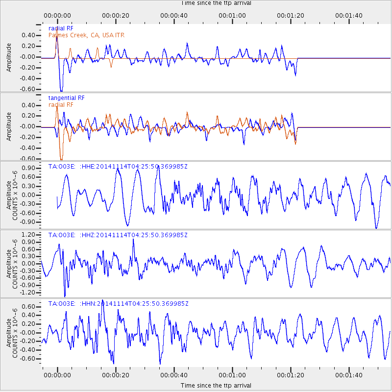
O03E Paynes Creek, CA, USA - Earthquake Result Viewer
*The percent match for this event was below the threshold and hence no stack was calculated.
| Earthquake location: |
Kuril Islands |
| Earthquake latitude/longitude: |
45.2/150.9 |
| Earthquake time(UTC): |
2014/11/14 (318) 04:16:07 GMT |
| Earthquake Depth: |
18 km |
| Earthquake Magnitude: |
5.7 MB |
| Earthquake Catalog/Contributor: |
NEIC PDE/NEIC COMCAT |
|
| Network: |
TA USArray Transportable Network (new EarthScope stations) |
| Station: |
O03E Paynes Creek, CA, USA |
| Lat/Lon: |
40.29 N/121.80 W |
| Elevation: |
967 m |
|
| Distance: |
61.2 deg |
| Az: |
60.656 deg |
| Baz: |
306.337 deg |
| Ray Param: |
$rayparam |
*The percent match for this event was below the threshold and hence was not used in the summary stack. |
|
| Radial Match: |
75.24033 % |
| Radial Bump: |
400 |
| Transverse Match: |
44.28312 % |
| Transverse Bump: |
400 |
| SOD ConfigId: |
817051 |
| Insert Time: |
2014-11-28 04:46:05.448 +0000 |
| GWidth: |
2.5 |
| Max Bumps: |
400 |
| Tol: |
0.001 |
|
Signal To Noise
| Channel | StoN | STA | LTA |
| TA:O03E: :HHZ:20141114T04:25:50.369985Z | 2.9353197 | 6.0324487E-7 | 2.055125E-7 |
| TA:O03E: :HHN:20141114T04:25:50.369985Z | 0.5619147 | 2.210683E-7 | 3.934197E-7 |
| TA:O03E: :HHE:20141114T04:25:50.369985Z | 1.2051622 | 5.1748344E-7 | 4.2938905E-7 |
| Arrivals |
| Ps | |
| PpPs | |
| PsPs/PpSs | |


