You are here: Home > Network List > TA - USArray Transportable Network (new EarthScope stations) Stations List
> Station U57A Blanch, NC, USA > Earthquake Result Viewer
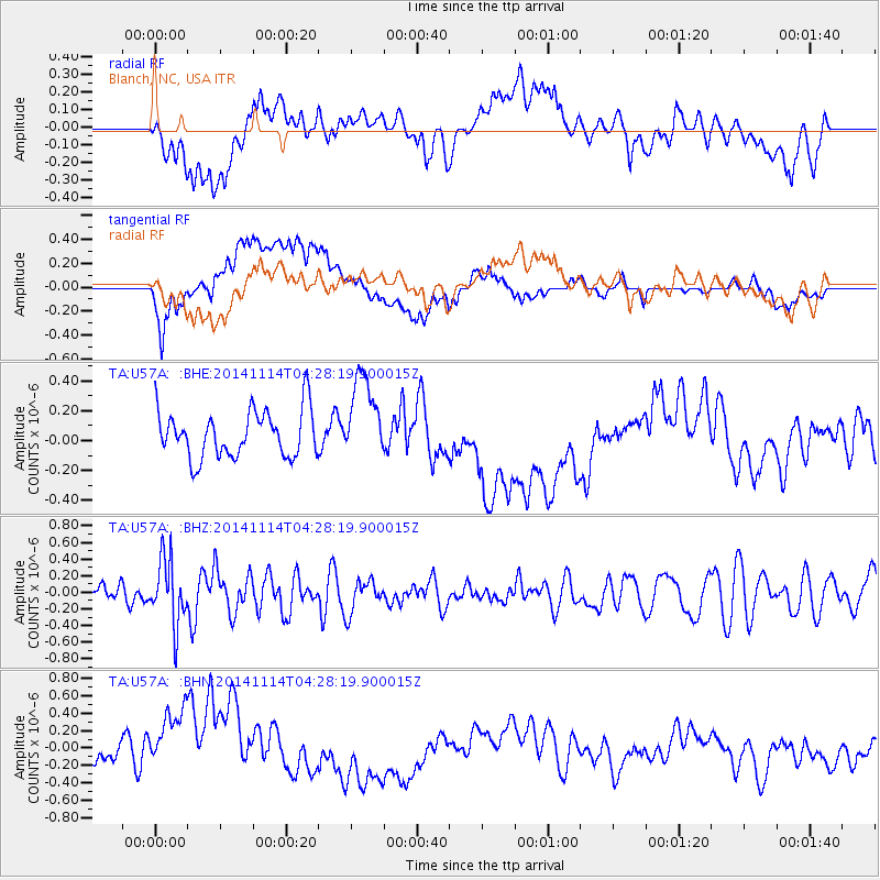
U57A Blanch, NC, USA - Earthquake Result Viewer
*The percent match for this event was below the threshold and hence no stack was calculated.
| Earthquake location: |
Kuril Islands |
| Earthquake latitude/longitude: |
45.2/150.9 |
| Earthquake time(UTC): |
2014/11/14 (318) 04:16:07 GMT |
| Earthquake Depth: |
18 km |
| Earthquake Magnitude: |
5.7 MB |
| Earthquake Catalog/Contributor: |
NEIC PDE/NEIC COMCAT |
|
| Network: |
TA USArray Transportable Network (new EarthScope stations) |
| Station: |
U57A Blanch, NC, USA |
| Lat/Lon: |
36.43 N/79.34 W |
| Elevation: |
178 m |
|
| Distance: |
86.9 deg |
| Az: |
38.398 deg |
| Baz: |
327.018 deg |
| Ray Param: |
$rayparam |
*The percent match for this event was below the threshold and hence was not used in the summary stack. |
|
| Radial Match: |
38.167755 % |
| Radial Bump: |
400 |
| Transverse Match: |
34.81585 % |
| Transverse Bump: |
400 |
| SOD ConfigId: |
817051 |
| Insert Time: |
2014-11-28 04:47:33.788 +0000 |
| GWidth: |
2.5 |
| Max Bumps: |
400 |
| Tol: |
0.001 |
|
Signal To Noise
| Channel | StoN | STA | LTA |
| TA:U57A: :BHZ:20141114T04:28:19.900015Z | 2.2752583 | 3.8694486E-7 | 1.7006636E-7 |
| TA:U57A: :BHN:20141114T04:28:19.900015Z | 2.4068472 | 5.400009E-7 | 2.2436026E-7 |
| TA:U57A: :BHE:20141114T04:28:19.900015Z | 1.8349773 | 2.8368052E-7 | 1.5459621E-7 |
| Arrivals |
| Ps | |
| PpPs | |
| PsPs/PpSs | |


