You are here: Home > Network List > TA - USArray Transportable Network (new EarthScope stations) Stations List
> Station W58A Raeford, NC, USA > Earthquake Result Viewer
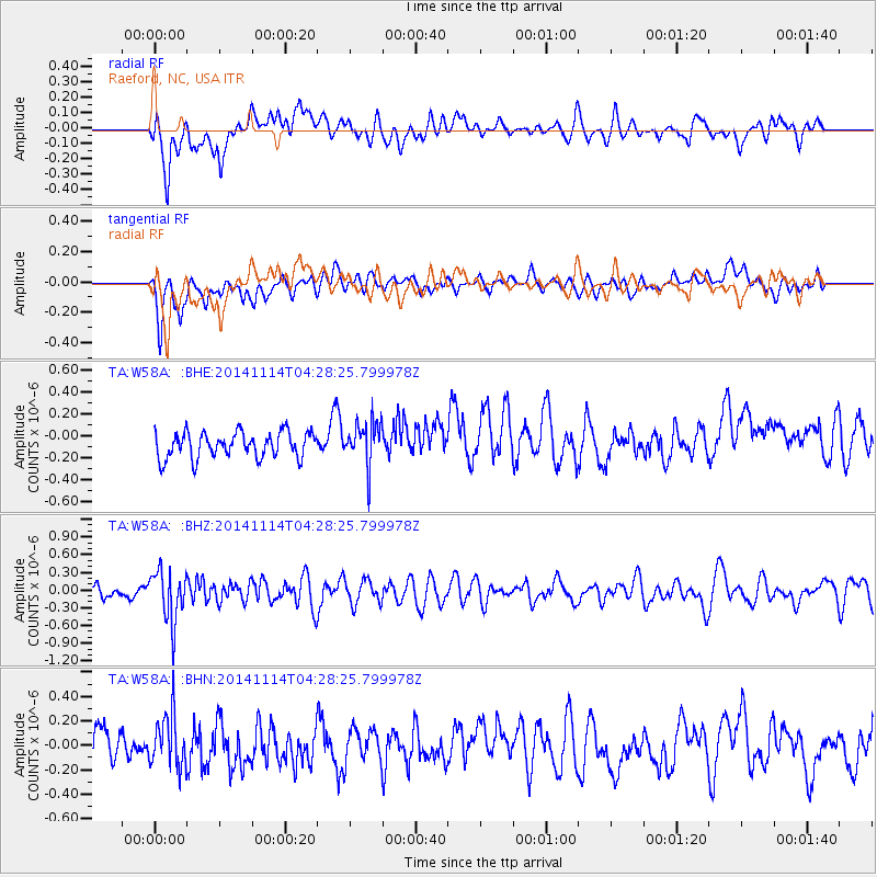
W58A Raeford, NC, USA - Earthquake Result Viewer
*The percent match for this event was below the threshold and hence no stack was calculated.
| Earthquake location: |
Kuril Islands |
| Earthquake latitude/longitude: |
45.2/150.9 |
| Earthquake time(UTC): |
2014/11/14 (318) 04:16:07 GMT |
| Earthquake Depth: |
18 km |
| Earthquake Magnitude: |
5.7 MB |
| Earthquake Catalog/Contributor: |
NEIC PDE/NEIC COMCAT |
|
| Network: |
TA USArray Transportable Network (new EarthScope stations) |
| Station: |
W58A Raeford, NC, USA |
| Lat/Lon: |
35.02 N/79.23 W |
| Elevation: |
84 m |
|
| Distance: |
88.1 deg |
| Az: |
39.094 deg |
| Baz: |
327.108 deg |
| Ray Param: |
$rayparam |
*The percent match for this event was below the threshold and hence was not used in the summary stack. |
|
| Radial Match: |
52.447483 % |
| Radial Bump: |
400 |
| Transverse Match: |
57.66722 % |
| Transverse Bump: |
400 |
| SOD ConfigId: |
817051 |
| Insert Time: |
2014-11-28 04:47:57.400 +0000 |
| GWidth: |
2.5 |
| Max Bumps: |
400 |
| Tol: |
0.001 |
|
Signal To Noise
| Channel | StoN | STA | LTA |
| TA:W58A: :BHZ:20141114T04:28:25.799978Z | 2.7435486 | 4.2982148E-7 | 1.5666625E-7 |
| TA:W58A: :BHN:20141114T04:28:25.799978Z | 1.5268089 | 2.0981125E-7 | 1.3741814E-7 |
| TA:W58A: :BHE:20141114T04:28:25.799978Z | 1.7267653 | 2.040058E-7 | 1.1814333E-7 |
| Arrivals |
| Ps | |
| PpPs | |
| PsPs/PpSs | |


