You are here: Home > Network List > US - United States National Seismic Network Stations List
> Station ERPA Erie, Pennsylvania, USA > Earthquake Result Viewer
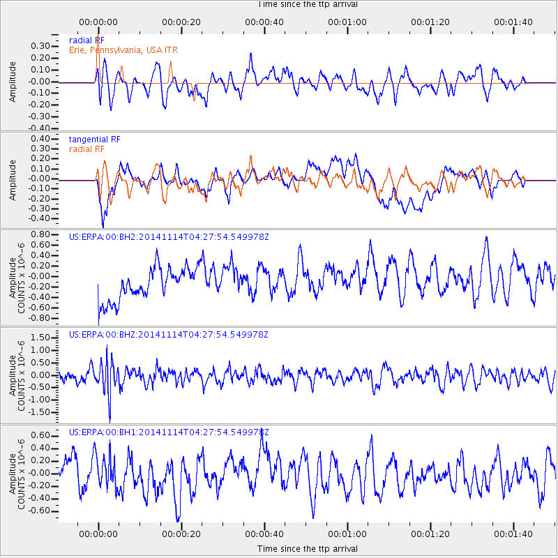
ERPA Erie, Pennsylvania, USA - Earthquake Result Viewer
*The percent match for this event was below the threshold and hence no stack was calculated.
| Earthquake location: |
Kuril Islands |
| Earthquake latitude/longitude: |
45.2/150.9 |
| Earthquake time(UTC): |
2014/11/14 (318) 04:16:07 GMT |
| Earthquake Depth: |
18 km |
| Earthquake Magnitude: |
5.7 MB |
| Earthquake Catalog/Contributor: |
NEIC PDE/NEIC COMCAT |
|
| Network: |
US United States National Seismic Network |
| Station: |
ERPA Erie, Pennsylvania, USA |
| Lat/Lon: |
42.12 N/79.99 W |
| Elevation: |
306 m |
|
| Distance: |
81.9 deg |
| Az: |
35.69 deg |
| Baz: |
326.341 deg |
| Ray Param: |
$rayparam |
*The percent match for this event was below the threshold and hence was not used in the summary stack. |
|
| Radial Match: |
48.522144 % |
| Radial Bump: |
400 |
| Transverse Match: |
46.452145 % |
| Transverse Bump: |
400 |
| SOD ConfigId: |
817051 |
| Insert Time: |
2014-11-28 04:49:53.910 +0000 |
| GWidth: |
2.5 |
| Max Bumps: |
400 |
| Tol: |
0.001 |
|
Signal To Noise
| Channel | StoN | STA | LTA |
| US:ERPA:00:BHZ:20141114T04:27:54.549978Z | 2.8789148 | 6.229327E-7 | 2.163776E-7 |
| US:ERPA:00:BH1:20141114T04:27:54.549978Z | 0.9404656 | 2.6744507E-7 | 2.8437518E-7 |
| US:ERPA:00:BH2:20141114T04:27:54.549978Z | 0.94516116 | 2.8846824E-7 | 3.0520533E-7 |
| Arrivals |
| Ps | |
| PpPs | |
| PsPs/PpSs | |


