You are here: Home > Network List > US - United States National Seismic Network Stations List
> Station GLMI Grayling, Michigan, USA > Earthquake Result Viewer
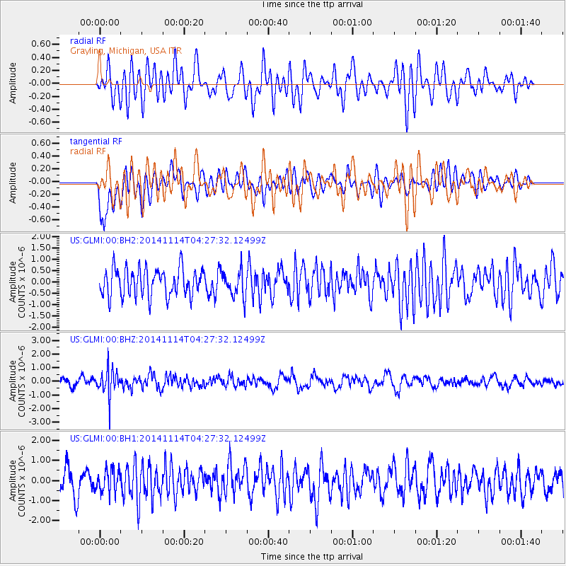
GLMI Grayling, Michigan, USA - Earthquake Result Viewer
*The percent match for this event was below the threshold and hence no stack was calculated.
| Earthquake location: |
Kuril Islands |
| Earthquake latitude/longitude: |
45.2/150.9 |
| Earthquake time(UTC): |
2014/11/14 (318) 04:16:07 GMT |
| Earthquake Depth: |
18 km |
| Earthquake Magnitude: |
5.7 MB |
| Earthquake Catalog/Contributor: |
NEIC PDE/NEIC COMCAT |
|
| Network: |
US United States National Seismic Network |
| Station: |
GLMI Grayling, Michigan, USA |
| Lat/Lon: |
44.82 N/84.62 W |
| Elevation: |
387 m |
|
| Distance: |
77.7 deg |
| Az: |
36.908 deg |
| Baz: |
323.382 deg |
| Ray Param: |
$rayparam |
*The percent match for this event was below the threshold and hence was not used in the summary stack. |
|
| Radial Match: |
52.444637 % |
| Radial Bump: |
400 |
| Transverse Match: |
62.015846 % |
| Transverse Bump: |
400 |
| SOD ConfigId: |
817051 |
| Insert Time: |
2014-11-28 04:49:58.648 +0000 |
| GWidth: |
2.5 |
| Max Bumps: |
400 |
| Tol: |
0.001 |
|
Signal To Noise
| Channel | StoN | STA | LTA |
| US:GLMI:00:BHZ:20141114T04:27:32.12499Z | 3.2110898 | 9.581285E-7 | 2.9838108E-7 |
| US:GLMI:00:BH1:20141114T04:27:32.12499Z | 0.92883724 | 5.567581E-7 | 5.994141E-7 |
| US:GLMI:00:BH2:20141114T04:27:32.12499Z | 0.96750754 | 5.7820563E-7 | 5.976239E-7 |
| Arrivals |
| Ps | |
| PpPs | |
| PsPs/PpSs | |


