You are here: Home > Network List > AV - Alaska Volcano Observatory Stations List
> Station SPCR Ckakachatna River, Mount Spurr, Alaska > Earthquake Result Viewer
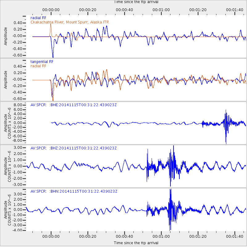
SPCR Ckakachatna River, Mount Spurr, Alaska - Earthquake Result Viewer
*The percent match for this event was below the threshold and hence no stack was calculated.
| Earthquake location: |
Near Coast Of Peru |
| Earthquake latitude/longitude: |
-12.7/-76.7 |
| Earthquake time(UTC): |
2014/11/15 (319) 00:18:40 GMT |
| Earthquake Depth: |
46 km |
| Earthquake Magnitude: |
5.6 MB |
| Earthquake Catalog/Contributor: |
NEIC PDE/NEIC COMCAT |
|
| Network: |
AV Alaska Volcano Observatory |
| Station: |
SPCR Ckakachatna River, Mount Spurr, Alaska |
| Lat/Lon: |
61.20 N/152.21 W |
| Elevation: |
984 m |
|
| Distance: |
94.1 deg |
| Az: |
331.969 deg |
| Baz: |
108.7 deg |
| Ray Param: |
$rayparam |
*The percent match for this event was below the threshold and hence was not used in the summary stack. |
|
| Radial Match: |
56.641605 % |
| Radial Bump: |
400 |
| Transverse Match: |
54.51118 % |
| Transverse Bump: |
400 |
| SOD ConfigId: |
817349 |
| Insert Time: |
2014-11-29 00:25:07.626 +0000 |
| GWidth: |
2.5 |
| Max Bumps: |
400 |
| Tol: |
0.001 |
|
Signal To Noise
| Channel | StoN | STA | LTA |
| AV:SPCR: :BHZ:20141115T00:31:22.439023Z | 1.0568244 | 3.8776804E-7 | 3.6691813E-7 |
| AV:SPCR: :BHN:20141115T00:31:22.439023Z | 0.44414514 | 1.8979944E-7 | 4.273365E-7 |
| AV:SPCR: :BHE:20141115T00:31:22.439023Z | 2.3441315 | 8.0608777E-7 | 3.438748E-7 |
| Arrivals |
| Ps | |
| PpPs | |
| PsPs/PpSs | |


