You are here: Home > Network List > US - United States National Seismic Network Stations List
> Station AMTX Amarillo, Texas, USA > Earthquake Result Viewer
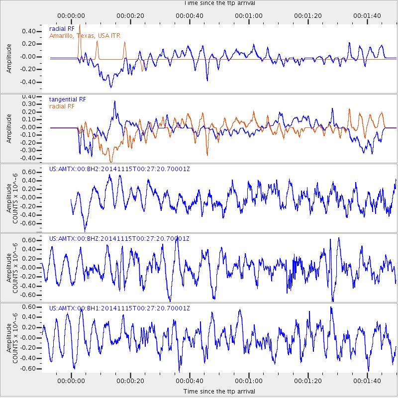
AMTX Amarillo, Texas, USA - Earthquake Result Viewer
*The percent match for this event was below the threshold and hence no stack was calculated.
| Earthquake location: |
Near Coast Of Peru |
| Earthquake latitude/longitude: |
-12.7/-76.7 |
| Earthquake time(UTC): |
2014/11/15 (319) 00:18:40 GMT |
| Earthquake Depth: |
46 km |
| Earthquake Magnitude: |
5.6 MB |
| Earthquake Catalog/Contributor: |
NEIC PDE/NEIC COMCAT |
|
| Network: |
US United States National Seismic Network |
| Station: |
AMTX Amarillo, Texas, USA |
| Lat/Lon: |
34.53 N/101.41 W |
| Elevation: |
1010 m |
|
| Distance: |
52.4 deg |
| Az: |
334.246 deg |
| Baz: |
149.092 deg |
| Ray Param: |
$rayparam |
*The percent match for this event was below the threshold and hence was not used in the summary stack. |
|
| Radial Match: |
47.73552 % |
| Radial Bump: |
400 |
| Transverse Match: |
56.00609 % |
| Transverse Bump: |
400 |
| SOD ConfigId: |
817349 |
| Insert Time: |
2014-11-29 00:43:37.696 +0000 |
| GWidth: |
2.5 |
| Max Bumps: |
400 |
| Tol: |
0.001 |
|
Signal To Noise
| Channel | StoN | STA | LTA |
| US:AMTX:00:BHZ:20141115T00:27:20.70001Z | 1.1685799 | 2.51216E-7 | 2.1497544E-7 |
| US:AMTX:00:BH1:20141115T00:27:20.70001Z | 1.7022179 | 4.2229374E-7 | 2.4808443E-7 |
| US:AMTX:00:BH2:20141115T00:27:20.70001Z | 0.72336715 | 2.0614166E-7 | 2.8497513E-7 |
| Arrivals |
| Ps | |
| PpPs | |
| PsPs/PpSs | |


