You are here: Home > Network List > AV - Alaska Volcano Observatory Stations List
> Station MAPS Pakushin Southeast, Makushin Volcano, Alaska > Earthquake Result Viewer
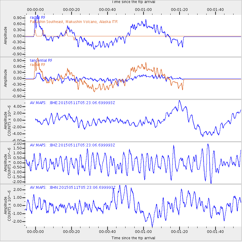
MAPS Pakushin Southeast, Makushin Volcano, Alaska - Earthquake Result Viewer
*The percent match for this event was below the threshold and hence no stack was calculated.
| Earthquake location: |
Irian Jaya Region, Indonesia |
| Earthquake latitude/longitude: |
-4.2/133.9 |
| Earthquake time(UTC): |
2015/05/11 (131) 05:11:55 GMT |
| Earthquake Depth: |
35 km |
| Earthquake Magnitude: |
4.2 mb, 4.2 mb |
| Earthquake Catalog/Contributor: |
ISC/ISC |
|
| Network: |
AV Alaska Volcano Observatory |
| Station: |
MAPS Pakushin Southeast, Makushin Volcano, Alaska |
| Lat/Lon: |
53.81 N/166.94 W |
| Elevation: |
333 m |
|
| Distance: |
75.8 deg |
| Az: |
31.679 deg |
| Baz: |
242.028 deg |
| Ray Param: |
$rayparam |
*The percent match for this event was below the threshold and hence was not used in the summary stack. |
|
| Radial Match: |
24.923006 % |
| Radial Bump: |
400 |
| Transverse Match: |
46.36925 % |
| Transverse Bump: |
400 |
| SOD ConfigId: |
7422571 |
| Insert Time: |
2019-04-18 19:31:10.300 +0000 |
| GWidth: |
2.5 |
| Max Bumps: |
400 |
| Tol: |
0.001 |
|
Signal To Noise
| Channel | StoN | STA | LTA |
| AV:MAPS: :BHZ:20150511T05:23:06.699993Z | 0.91974026 | 5.4819867E-7 | 5.9603644E-7 |
| AV:MAPS: :BHN:20150511T05:23:06.699993Z | 1.324509 | 6.206219E-7 | 4.685675E-7 |
| AV:MAPS: :BHE:20150511T05:23:06.699993Z | 1.3414543 | 1.2352164E-6 | 9.208039E-7 |
| Arrivals |
| Ps | |
| PpPs | |
| PsPs/PpSs | |


