You are here: Home > Network List > AV - Alaska Volcano Observatory Stations List
> Station MAPS Pakushin Southeast, Makushin Volcano, Alaska > Earthquake Result Viewer
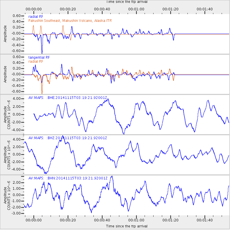
MAPS Pakushin Southeast, Makushin Volcano, Alaska - Earthquake Result Viewer
*The percent match for this event was below the threshold and hence no stack was calculated.
| Earthquake location: |
Minahassa Peninsula, Sulawesi |
| Earthquake latitude/longitude: |
-0.1/123.9 |
| Earthquake time(UTC): |
2014/11/15 (319) 03:08:04 GMT |
| Earthquake Depth: |
85 km |
| Earthquake Magnitude: |
5.8 MB |
| Earthquake Catalog/Contributor: |
NEIC PDE/NEIC COMCAT |
|
| Network: |
AV Alaska Volcano Observatory |
| Station: |
MAPS Pakushin Southeast, Makushin Volcano, Alaska |
| Lat/Lon: |
53.81 N/166.94 W |
| Elevation: |
333 m |
|
| Distance: |
77.9 deg |
| Az: |
34.525 deg |
| Baz: |
252.869 deg |
| Ray Param: |
$rayparam |
*The percent match for this event was below the threshold and hence was not used in the summary stack. |
|
| Radial Match: |
89.27728 % |
| Radial Bump: |
366 |
| Transverse Match: |
87.521545 % |
| Transverse Bump: |
395 |
| SOD ConfigId: |
817472 |
| Insert Time: |
2014-11-29 03:18:00.790 +0000 |
| GWidth: |
2.5 |
| Max Bumps: |
400 |
| Tol: |
0.001 |
|
Signal To Noise
| Channel | StoN | STA | LTA |
| AV:MAPS: :BHZ:20141115T03:19:21.92001Z | 1.6378312 | 2.4296053E-6 | 1.4834284E-6 |
| AV:MAPS: :BHN:20141115T03:19:21.92001Z | 0.56354606 | 6.52545E-7 | 1.1579266E-6 |
| AV:MAPS: :BHE:20141115T03:19:21.92001Z | 2.9187453 | 2.9740936E-6 | 1.0189631E-6 |
| Arrivals |
| Ps | |
| PpPs | |
| PsPs/PpSs | |


