You are here: Home > Network List > CN - Canadian National Seismograph Network Stations List
> Station INK INUVIK, NT > Earthquake Result Viewer
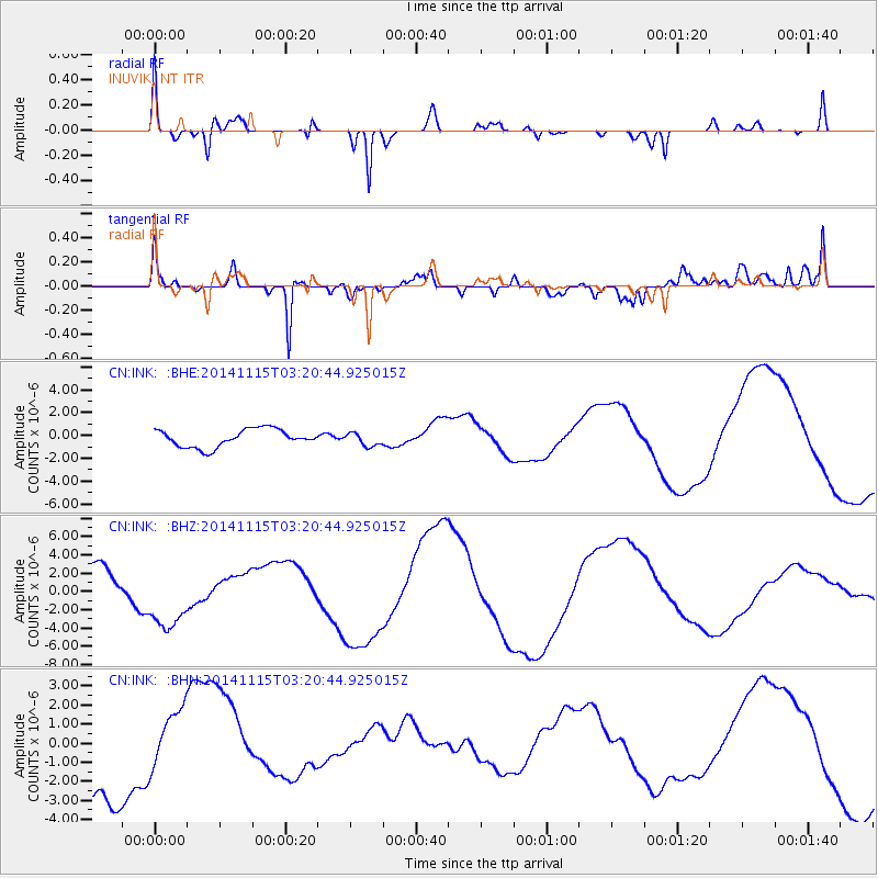
INK INUVIK, NT - Earthquake Result Viewer
*The percent match for this event was below the threshold and hence no stack was calculated.
| Earthquake location: |
Minahassa Peninsula, Sulawesi |
| Earthquake latitude/longitude: |
-0.1/123.9 |
| Earthquake time(UTC): |
2014/11/15 (319) 03:08:04 GMT |
| Earthquake Depth: |
85 km |
| Earthquake Magnitude: |
5.8 MB |
| Earthquake Catalog/Contributor: |
NEIC PDE/NEIC COMCAT |
|
| Network: |
CN Canadian National Seismograph Network |
| Station: |
INK INUVIK, NT |
| Lat/Lon: |
68.31 N/133.53 W |
| Elevation: |
44 m |
|
| Distance: |
94.8 deg |
| Az: |
21.355 deg |
| Baz: |
281.638 deg |
| Ray Param: |
$rayparam |
*The percent match for this event was below the threshold and hence was not used in the summary stack. |
|
| Radial Match: |
90.47123 % |
| Radial Bump: |
378 |
| Transverse Match: |
84.45131 % |
| Transverse Bump: |
400 |
| SOD ConfigId: |
817472 |
| Insert Time: |
2014-11-29 03:18:42.269 +0000 |
| GWidth: |
2.5 |
| Max Bumps: |
400 |
| Tol: |
0.001 |
|
Signal To Noise
| Channel | StoN | STA | LTA |
| CN:INK: :BHZ:20141115T03:20:44.925015Z | 1.9395123 | 3.7698887E-6 | 1.9437302E-6 |
| CN:INK: :BHN:20141115T03:20:44.925015Z | 0.6352551 | 1.514241E-6 | 2.383674E-6 |
| CN:INK: :BHE:20141115T03:20:44.925015Z | 0.7593696 | 5.846809E-7 | 7.699556E-7 |
| Arrivals |
| Ps | |
| PpPs | |
| PsPs/PpSs | |


