You are here: Home > Network List > IC - New China Digital Seismograph Network Stations List
> Station KMI Kunming, Yunnan Province, China > Earthquake Result Viewer
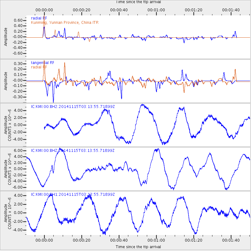
KMI Kunming, Yunnan Province, China - Earthquake Result Viewer
*The percent match for this event was below the threshold and hence no stack was calculated.
| Earthquake location: |
Minahassa Peninsula, Sulawesi |
| Earthquake latitude/longitude: |
-0.1/123.9 |
| Earthquake time(UTC): |
2014/11/15 (319) 03:08:04 GMT |
| Earthquake Depth: |
85 km |
| Earthquake Magnitude: |
5.8 MB |
| Earthquake Catalog/Contributor: |
NEIC PDE/NEIC COMCAT |
|
| Network: |
IC New China Digital Seismograph Network |
| Station: |
KMI Kunming, Yunnan Province, China |
| Lat/Lon: |
25.12 N/102.74 E |
| Elevation: |
1975 m |
|
| Distance: |
32.4 deg |
| Az: |
322.347 deg |
| Baz: |
137.632 deg |
| Ray Param: |
$rayparam |
*The percent match for this event was below the threshold and hence was not used in the summary stack. |
|
| Radial Match: |
61.368412 % |
| Radial Bump: |
400 |
| Transverse Match: |
57.51834 % |
| Transverse Bump: |
298 |
| SOD ConfigId: |
817472 |
| Insert Time: |
2014-11-29 03:20:14.544 +0000 |
| GWidth: |
2.5 |
| Max Bumps: |
400 |
| Tol: |
0.001 |
|
Signal To Noise
| Channel | StoN | STA | LTA |
| IC:KMI:00:BHZ:20141115T03:13:55.71899Z | 1.1584927 | 3.7242537E-6 | 3.214741E-6 |
| IC:KMI:00:BH1:20141115T03:13:55.71899Z | 1.5158215 | 3.1742654E-6 | 2.0940893E-6 |
| IC:KMI:00:BH2:20141115T03:13:55.71899Z | 3.1461515 | 3.775958E-6 | 1.2001831E-6 |
| Arrivals |
| Ps | |
| PpPs | |
| PsPs/PpSs | |


