You are here: Home > Network List > UW - Pacific Northwest Regional Seismic Network Stations List
> Station LEBA Lebam, WA, USA > Earthquake Result Viewer
LEBA Lebam, WA, USA - Earthquake Result Viewer
*The percent match for this event was below the threshold and hence no stack was calculated.
| Earthquake location: |
Off E. Coast Of N. Island, N.Z. |
| Earthquake latitude/longitude: |
-37.7/179.7 |
| Earthquake time(UTC): |
2014/11/16 (320) 22:33:20 GMT |
| Earthquake Depth: |
22 km |
| Earthquake Magnitude: |
6.7 MWW, 6.7 MWC, 6.7 MI |
| Earthquake Catalog/Contributor: |
NEIC PDE/NEIC COMCAT |
|
| Network: |
UW Pacific Northwest Regional Seismic Network |
| Station: |
LEBA Lebam, WA, USA |
| Lat/Lon: |
46.55 N/123.56 W |
| Elevation: |
73 m |
|
| Distance: |
98.1 deg |
| Az: |
35.66 deg |
| Baz: |
222.078 deg |
| Ray Param: |
$rayparam |
*The percent match for this event was below the threshold and hence was not used in the summary stack. |
|
| Radial Match: |
67.524506 % |
| Radial Bump: |
400 |
| Transverse Match: |
62.52992 % |
| Transverse Bump: |
400 |
| SOD ConfigId: |
818021 |
| Insert Time: |
2014-11-30 22:51:33.254 +0000 |
| GWidth: |
2.5 |
| Max Bumps: |
400 |
| Tol: |
0.001 |
|
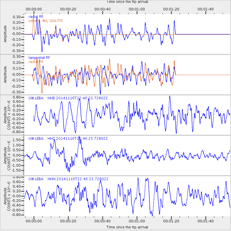
Signal To Noise
| Channel | StoN | STA | LTA |
| UW:LEBA: :HHZ:20141116T22:46:23.72802Z | 2.1058016 | 3.4033465E-7 | 1.6161763E-7 |
| UW:LEBA: :HHN:20141116T22:46:23.72802Z | 0.9381277 | 2.469869E-7 | 2.632764E-7 |
| UW:LEBA: :HHE:20141116T22:46:23.72802Z | 1.2706832 | 4.344214E-7 | 3.418802E-7 |
| Arrivals |
| Ps | |
| PpPs | |
| PsPs/PpSs | |


