You are here: Home > Network List > US - United States National Seismic Network Stations List
> Station DGMT Dagmar, Montana, USA > Earthquake Result Viewer
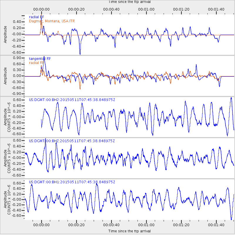
DGMT Dagmar, Montana, USA - Earthquake Result Viewer
*The percent match for this event was below the threshold and hence no stack was calculated.
| Earthquake location: |
Kuril Islands |
| Earthquake latitude/longitude: |
47.2/154.1 |
| Earthquake time(UTC): |
2015/05/11 (131) 07:35:44 GMT |
| Earthquake Depth: |
22 km |
| Earthquake Magnitude: |
5.2 MW, 4.7 MS, 5.3 mb |
| Earthquake Catalog/Contributor: |
ISC/ISC |
|
| Network: |
US United States National Seismic Network |
| Station: |
DGMT Dagmar, Montana, USA |
| Lat/Lon: |
48.47 N/104.20 W |
| Elevation: |
0.0 m |
|
| Distance: |
63.0 deg |
| Az: |
46.978 deg |
| Baz: |
311.478 deg |
| Ray Param: |
$rayparam |
*The percent match for this event was below the threshold and hence was not used in the summary stack. |
|
| Radial Match: |
64.192856 % |
| Radial Bump: |
400 |
| Transverse Match: |
70.834984 % |
| Transverse Bump: |
400 |
| SOD ConfigId: |
7422571 |
| Insert Time: |
2019-04-18 19:39:34.540 +0000 |
| GWidth: |
2.5 |
| Max Bumps: |
400 |
| Tol: |
0.001 |
|
Signal To Noise
| Channel | StoN | STA | LTA |
| US:DGMT:00:BHZ:20150511T07:45:38.848975Z | 2.5590832 | 3.0786788E-7 | 1.2030397E-7 |
| US:DGMT:00:BH1:20150511T07:45:38.848975Z | 0.4031796 | 1.2052291E-7 | 2.989311E-7 |
| US:DGMT:00:BH2:20150511T07:45:38.848975Z | 0.38849762 | 1.11923015E-7 | 2.880919E-7 |
| Arrivals |
| Ps | |
| PpPs | |
| PsPs/PpSs | |


