You are here: Home > Network List > TA - USArray Transportable Network (new EarthScope stations) Stations List
> Station O03E Paynes Creek, CA, USA > Earthquake Result Viewer
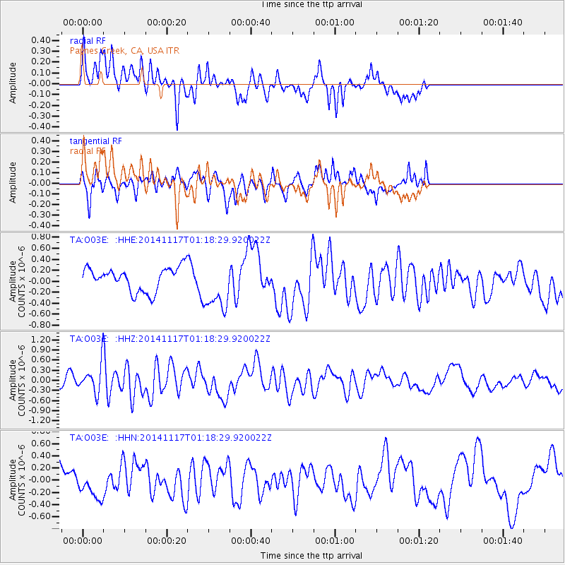
O03E Paynes Creek, CA, USA - Earthquake Result Viewer
*The percent match for this event was below the threshold and hence no stack was calculated.
| Earthquake location: |
D'Entrecasteaux Islands Region |
| Earthquake latitude/longitude: |
-9.6/155.2 |
| Earthquake time(UTC): |
2014/11/17 (321) 01:06:00 GMT |
| Earthquake Depth: |
25 km |
| Earthquake Magnitude: |
6.1 MWP |
| Earthquake Catalog/Contributor: |
NEIC PDE/NEIC COMCAT |
|
| Network: |
TA USArray Transportable Network (new EarthScope stations) |
| Station: |
O03E Paynes Creek, CA, USA |
| Lat/Lon: |
40.29 N/121.80 W |
| Elevation: |
967 m |
|
| Distance: |
90.9 deg |
| Az: |
49.405 deg |
| Baz: |
258.285 deg |
| Ray Param: |
$rayparam |
*The percent match for this event was below the threshold and hence was not used in the summary stack. |
|
| Radial Match: |
67.72621 % |
| Radial Bump: |
400 |
| Transverse Match: |
77.98721 % |
| Transverse Bump: |
400 |
| SOD ConfigId: |
818264 |
| Insert Time: |
2014-12-01 01:27:25.424 +0000 |
| GWidth: |
2.5 |
| Max Bumps: |
400 |
| Tol: |
0.001 |
|
Signal To Noise
| Channel | StoN | STA | LTA |
| TA:O03E: :HHZ:20141117T01:18:29.920022Z | 2.7427444 | 4.180748E-7 | 1.5242937E-7 |
| TA:O03E: :HHN:20141117T01:18:29.920022Z | 0.7878353 | 1.7499022E-7 | 2.2211522E-7 |
| TA:O03E: :HHE:20141117T01:18:29.920022Z | 2.168137 | 4.6089204E-7 | 2.1257513E-7 |
| Arrivals |
| Ps | |
| PpPs | |
| PsPs/PpSs | |


