You are here: Home > Network List > II - Global Seismograph Network (GSN - IRIS/IDA) Stations List
> Station WRAB Tennant Creek, NT, Australia > Earthquake Result Viewer
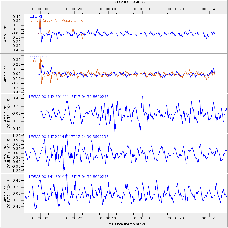
WRAB Tennant Creek, NT, Australia - Earthquake Result Viewer
*The percent match for this event was below the threshold and hence no stack was calculated.
| Earthquake location: |
Prince Edward Islands Region |
| Earthquake latitude/longitude: |
-46.4/33.8 |
| Earthquake time(UTC): |
2014/11/17 (321) 16:52:46 GMT |
| Earthquake Depth: |
10 km |
| Earthquake Magnitude: |
6.2 MWB |
| Earthquake Catalog/Contributor: |
NEIC PDE/NEIC COMCAT |
|
| Network: |
II Global Seismograph Network (GSN - IRIS/IDA) |
| Station: |
WRAB Tennant Creek, NT, Australia |
| Lat/Lon: |
19.93 S/134.36 E |
| Elevation: |
366 m |
|
| Distance: |
82.8 deg |
| Az: |
111.237 deg |
| Baz: |
223.328 deg |
| Ray Param: |
$rayparam |
*The percent match for this event was below the threshold and hence was not used in the summary stack. |
|
| Radial Match: |
67.55349 % |
| Radial Bump: |
400 |
| Transverse Match: |
58.41491 % |
| Transverse Bump: |
380 |
| SOD ConfigId: |
818500 |
| Insert Time: |
2014-12-01 17:09:47.595 +0000 |
| GWidth: |
2.5 |
| Max Bumps: |
400 |
| Tol: |
0.001 |
|
Signal To Noise
| Channel | StoN | STA | LTA |
| II:WRAB:00:BHZ:20141117T17:04:39.869023Z | 2.9145057 | 4.8702856E-7 | 1.6710503E-7 |
| II:WRAB:00:BH1:20141117T17:04:39.869023Z | 2.3081007 | 2.154227E-7 | 9.333332E-8 |
| II:WRAB:00:BH2:20141117T17:04:39.869023Z | 0.66479707 | 9.614845E-8 | 1.4462827E-7 |
| Arrivals |
| Ps | |
| PpPs | |
| PsPs/PpSs | |


