You are here: Home > Network List > CN - Canadian National Seismograph Network Stations List
> Station INK INUVIK, NT > Earthquake Result Viewer
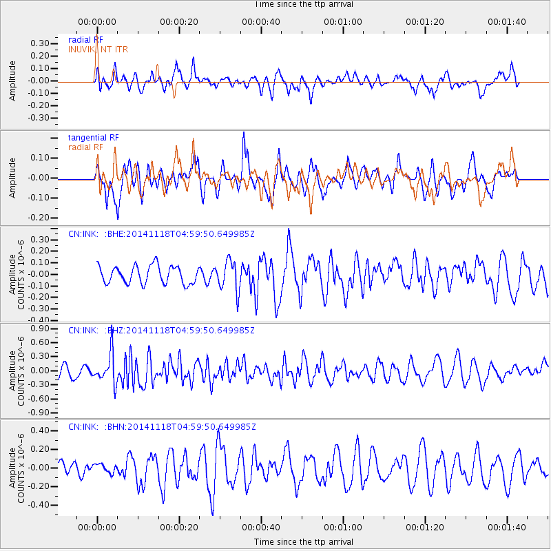
INK INUVIK, NT - Earthquake Result Viewer
*The percent match for this event was below the threshold and hence no stack was calculated.
| Earthquake location: |
Northern Molucca Sea |
| Earthquake latitude/longitude: |
1.9/126.5 |
| Earthquake time(UTC): |
2014/11/18 (322) 04:47:20 GMT |
| Earthquake Depth: |
65 km |
| Earthquake Magnitude: |
5.9 MB, 5.9 MWB |
| Earthquake Catalog/Contributor: |
NEIC PDE/NEIC COMCAT |
|
| Network: |
CN Canadian National Seismograph Network |
| Station: |
INK INUVIK, NT |
| Lat/Lon: |
68.31 N/133.53 W |
| Elevation: |
44 m |
|
| Distance: |
92.0 deg |
| Az: |
21.493 deg |
| Baz: |
279.95 deg |
| Ray Param: |
$rayparam |
*The percent match for this event was below the threshold and hence was not used in the summary stack. |
|
| Radial Match: |
48.769306 % |
| Radial Bump: |
400 |
| Transverse Match: |
39.759975 % |
| Transverse Bump: |
397 |
| SOD ConfigId: |
818500 |
| Insert Time: |
2014-12-02 04:59:23.264 +0000 |
| GWidth: |
2.5 |
| Max Bumps: |
400 |
| Tol: |
0.001 |
|
Signal To Noise
| Channel | StoN | STA | LTA |
| CN:INK: :BHZ:20141118T04:59:50.649985Z | 2.1636937 | 3.322322E-7 | 1.5354864E-7 |
| CN:INK: :BHN:20141118T04:59:50.649985Z | 0.5671767 | 4.7738947E-8 | 8.4169436E-8 |
| CN:INK: :BHE:20141118T04:59:50.649985Z | 1.7650514 | 1.3356367E-7 | 7.567127E-8 |
| Arrivals |
| Ps | |
| PpPs | |
| PsPs/PpSs | |


