You are here: Home > Network List > TA - USArray Transportable Network (new EarthScope stations) Stations List
> Station A21K Barrow, AK, USA > Earthquake Result Viewer
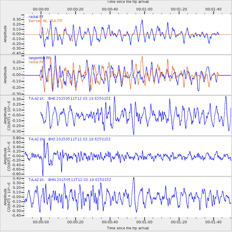
A21K Barrow, AK, USA - Earthquake Result Viewer
*The percent match for this event was below the threshold and hence no stack was calculated.
| Earthquake location: |
Solomon Islands |
| Earthquake latitude/longitude: |
-7.2/154.4 |
| Earthquake time(UTC): |
2015/05/11 (131) 11:51:20 GMT |
| Earthquake Depth: |
39 km |
| Earthquake Magnitude: |
5.5 MB |
| Earthquake Catalog/Contributor: |
NEIC PDE/NEIC COMCAT |
|
| Network: |
TA USArray Transportable Network (new EarthScope stations) |
| Station: |
A21K Barrow, AK, USA |
| Lat/Lon: |
71.32 N/156.62 W |
| Elevation: |
577 m |
|
| Distance: |
84.8 deg |
| Az: |
14.134 deg |
| Baz: |
228.765 deg |
| Ray Param: |
$rayparam |
*The percent match for this event was below the threshold and hence was not used in the summary stack. |
|
| Radial Match: |
64.4344 % |
| Radial Bump: |
400 |
| Transverse Match: |
64.27154 % |
| Transverse Bump: |
400 |
| SOD ConfigId: |
7422571 |
| Insert Time: |
2019-04-18 19:45:32.674 +0000 |
| GWidth: |
2.5 |
| Max Bumps: |
400 |
| Tol: |
0.001 |
|
Signal To Noise
| Channel | StoN | STA | LTA |
| TA:A21K: :BHZ:20150511T12:03:19.625015Z | 4.333859 | 3.8349987E-7 | 8.848923E-8 |
| TA:A21K: :BHN:20150511T12:03:19.625015Z | 2.1039932 | 1.5229902E-7 | 7.2385696E-8 |
| TA:A21K: :BHE:20150511T12:03:19.625015Z | 0.59320337 | 6.405995E-8 | 1.0798986E-7 |
| Arrivals |
| Ps | |
| PpPs | |
| PsPs/PpSs | |


