You are here: Home > Network List > TA - USArray Transportable Network (new EarthScope stations) Stations List
> Station A36M Sachs Harbour, NT, CAN > Earthquake Result Viewer
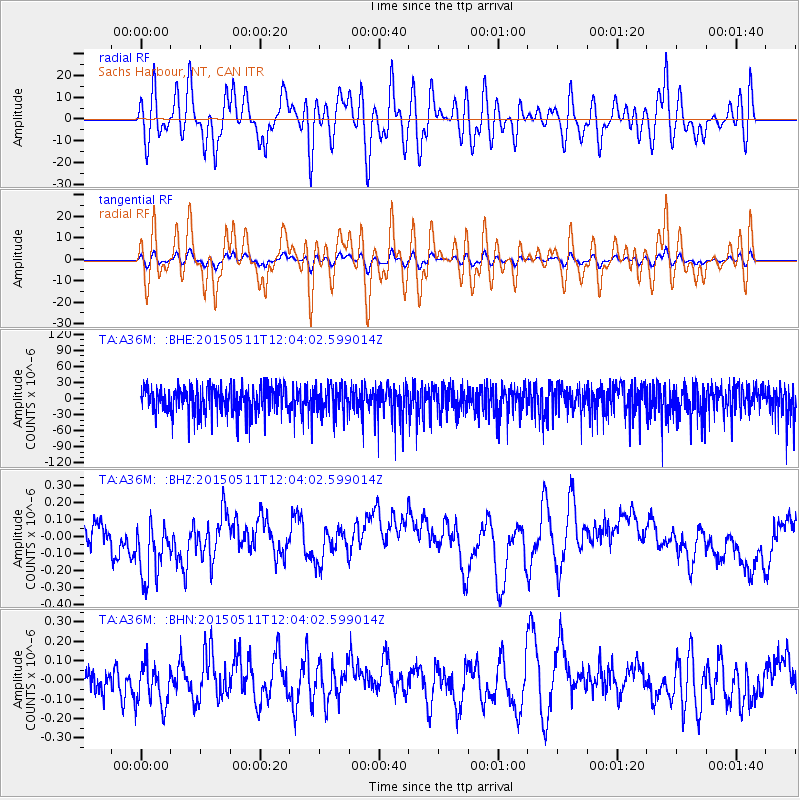
A36M Sachs Harbour, NT, CAN - Earthquake Result Viewer
*The percent match for this event was below the threshold and hence no stack was calculated.
| Earthquake location: |
Solomon Islands |
| Earthquake latitude/longitude: |
-7.2/154.4 |
| Earthquake time(UTC): |
2015/05/11 (131) 11:51:20 GMT |
| Earthquake Depth: |
39 km |
| Earthquake Magnitude: |
5.5 MB |
| Earthquake Catalog/Contributor: |
NEIC PDE/NEIC COMCAT |
|
| Network: |
TA USArray Transportable Network (new EarthScope stations) |
| Station: |
A36M Sachs Harbour, NT, CAN |
| Lat/Lon: |
71.99 N/125.25 W |
| Elevation: |
32 m |
|
| Distance: |
93.8 deg |
| Az: |
17.904 deg |
| Baz: |
258.641 deg |
| Ray Param: |
$rayparam |
*The percent match for this event was below the threshold and hence was not used in the summary stack. |
|
| Radial Match: |
44.062775 % |
| Radial Bump: |
400 |
| Transverse Match: |
43.881622 % |
| Transverse Bump: |
400 |
| SOD ConfigId: |
7422571 |
| Insert Time: |
2019-04-18 19:45:32.893 +0000 |
| GWidth: |
2.5 |
| Max Bumps: |
400 |
| Tol: |
0.001 |
|
Signal To Noise
| Channel | StoN | STA | LTA |
| TA:A36M: :BHZ:20150511T12:04:02.599014Z | 2.0635629 | 1.9132247E-7 | 9.271463E-8 |
| TA:A36M: :BHN:20150511T12:04:02.599014Z | 1.4604368 | 1.160368E-7 | 7.945349E-8 |
| TA:A36M: :BHE:20150511T12:04:02.599014Z | 1.0207429 | 2.5781206E-5 | 2.5257297E-5 |
| Arrivals |
| Ps | |
| PpPs | |
| PsPs/PpSs | |


