You are here: Home > Network List > AK - Alaska Regional Network Stations List
> Station MDM Murphy Dome > Earthquake Result Viewer
MDM Murphy Dome - Earthquake Result Viewer
*The percent match for this event was below the threshold and hence no stack was calculated.
| Earthquake location: |
Myanmar-India Border Region |
| Earthquake latitude/longitude: |
23.5/93.5 |
| Earthquake time(UTC): |
2014/11/20 (324) 18:14:37 GMT |
| Earthquake Depth: |
48 km |
| Earthquake Magnitude: |
5.6 MWB |
| Earthquake Catalog/Contributor: |
NEIC PDE/NEIC COMCAT |
|
| Network: |
AK Alaska Regional Network |
| Station: |
MDM Murphy Dome |
| Lat/Lon: |
64.96 N/148.23 W |
| Elevation: |
634 m |
|
| Distance: |
80.0 deg |
| Az: |
22.378 deg |
| Baz: |
304.804 deg |
| Ray Param: |
$rayparam |
*The percent match for this event was below the threshold and hence was not used in the summary stack. |
|
| Radial Match: |
65.3678 % |
| Radial Bump: |
400 |
| Transverse Match: |
40.822296 % |
| Transverse Bump: |
293 |
| SOD ConfigId: |
818775 |
| Insert Time: |
2014-12-04 18:26:25.394 +0000 |
| GWidth: |
2.5 |
| Max Bumps: |
400 |
| Tol: |
0.001 |
|
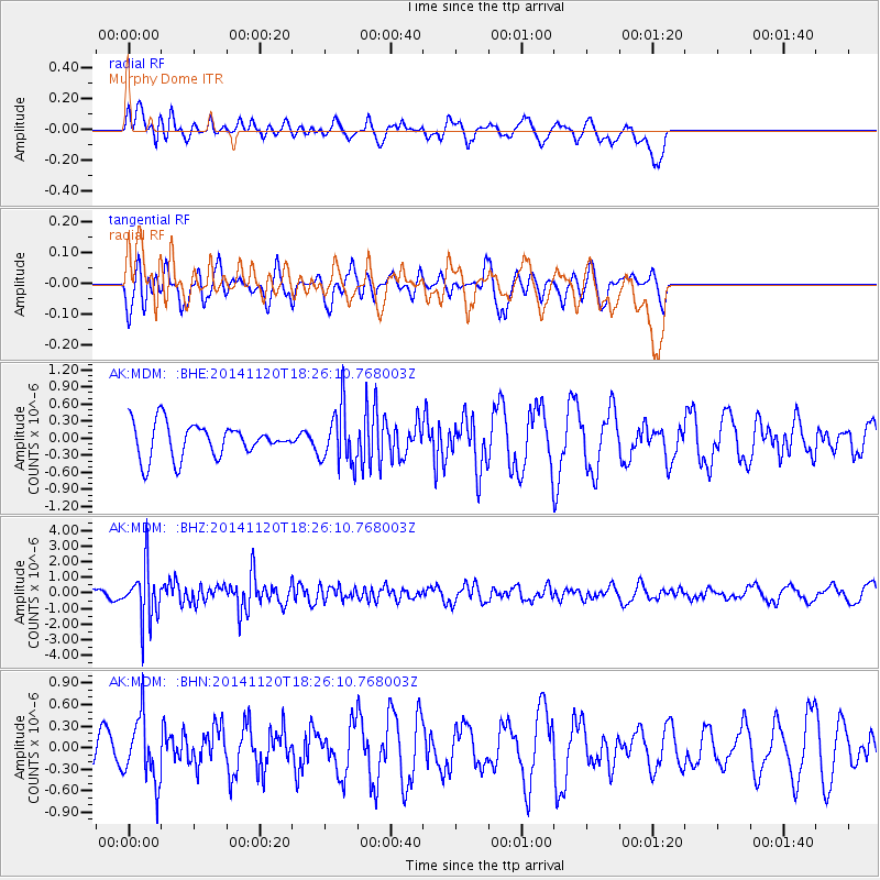
Signal To Noise
| Channel | StoN | STA | LTA |
| AK:MDM: :BHZ:20141120T18:26:10.768003Z | 5.678321 | 1.7313624E-6 | 3.0490747E-7 |
| AK:MDM: :BHN:20141120T18:26:10.768003Z | 1.9789302 | 4.484257E-7 | 2.2660006E-7 |
| AK:MDM: :BHE:20141120T18:26:10.768003Z | 1.6675136 | 4.920629E-7 | 2.950878E-7 |
| Arrivals |
| Ps | |
| PpPs | |
| PsPs/PpSs | |


