You are here: Home > Network List > CN - Canadian National Seismograph Network Stations List
> Station INK INUVIK, NT > Earthquake Result Viewer
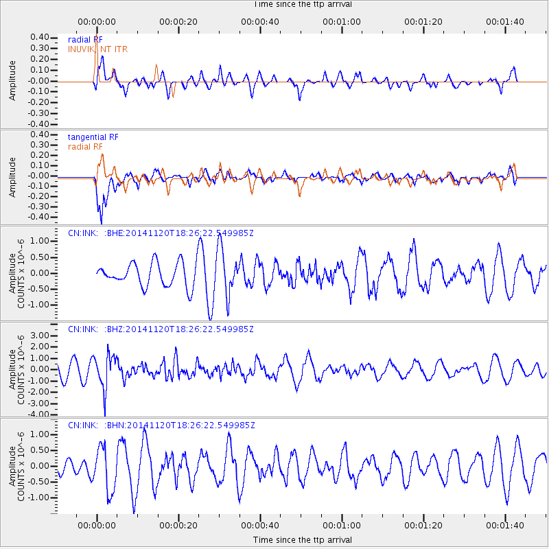
INK INUVIK, NT - Earthquake Result Viewer
*The percent match for this event was below the threshold and hence no stack was calculated.
| Earthquake location: |
Myanmar-India Border Region |
| Earthquake latitude/longitude: |
23.5/93.5 |
| Earthquake time(UTC): |
2014/11/20 (324) 18:14:37 GMT |
| Earthquake Depth: |
48 km |
| Earthquake Magnitude: |
5.6 MWB |
| Earthquake Catalog/Contributor: |
NEIC PDE/NEIC COMCAT |
|
| Network: |
CN Canadian National Seismograph Network |
| Station: |
INK INUVIK, NT |
| Lat/Lon: |
68.31 N/133.53 W |
| Elevation: |
44 m |
|
| Distance: |
82.2 deg |
| Az: |
15.941 deg |
| Baz: |
317.306 deg |
| Ray Param: |
$rayparam |
*The percent match for this event was below the threshold and hence was not used in the summary stack. |
|
| Radial Match: |
46.27594 % |
| Radial Bump: |
400 |
| Transverse Match: |
76.72721 % |
| Transverse Bump: |
400 |
| SOD ConfigId: |
818775 |
| Insert Time: |
2014-12-04 18:30:13.950 +0000 |
| GWidth: |
2.5 |
| Max Bumps: |
400 |
| Tol: |
0.001 |
|
Signal To Noise
| Channel | StoN | STA | LTA |
| CN:INK: :BHZ:20141120T18:26:22.549985Z | 1.7045302 | 1.4623023E-6 | 8.578917E-7 |
| CN:INK: :BHN:20141120T18:26:22.549985Z | 2.5918052 | 6.8881934E-7 | 2.657682E-7 |
| CN:INK: :BHE:20141120T18:26:22.549985Z | 1.9640777 | 7.2019844E-7 | 3.666853E-7 |
| Arrivals |
| Ps | |
| PpPs | |
| PsPs/PpSs | |


