You are here: Home > Network List > TA - USArray Transportable Network (new EarthScope stations) Stations List
> Station N25K Chitina, Valdez-Cordova, AK, USA > Earthquake Result Viewer
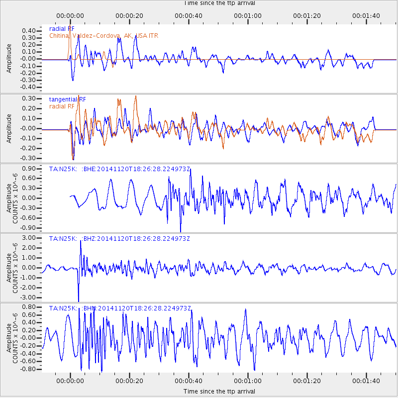
N25K Chitina, Valdez-Cordova, AK, USA - Earthquake Result Viewer
*The percent match for this event was below the threshold and hence no stack was calculated.
| Earthquake location: |
Myanmar-India Border Region |
| Earthquake latitude/longitude: |
23.5/93.5 |
| Earthquake time(UTC): |
2014/11/20 (324) 18:14:37 GMT |
| Earthquake Depth: |
48 km |
| Earthquake Magnitude: |
5.6 MWB |
| Earthquake Catalog/Contributor: |
NEIC PDE/NEIC COMCAT |
|
| Network: |
TA USArray Transportable Network (new EarthScope stations) |
| Station: |
N25K Chitina, Valdez-Cordova, AK, USA |
| Lat/Lon: |
61.61 N/144.60 W |
| Elevation: |
1087 m |
|
| Distance: |
83.3 deg |
| Az: |
24.122 deg |
| Baz: |
308.298 deg |
| Ray Param: |
$rayparam |
*The percent match for this event was below the threshold and hence was not used in the summary stack. |
|
| Radial Match: |
61.069485 % |
| Radial Bump: |
400 |
| Transverse Match: |
55.281567 % |
| Transverse Bump: |
400 |
| SOD ConfigId: |
818775 |
| Insert Time: |
2014-12-04 18:38:59.536 +0000 |
| GWidth: |
2.5 |
| Max Bumps: |
400 |
| Tol: |
0.001 |
|
Signal To Noise
| Channel | StoN | STA | LTA |
| TA:N25K: :BHZ:20141120T18:26:28.224973Z | 4.9233437 | 9.849668E-7 | 2.0006054E-7 |
| TA:N25K: :BHN:20141120T18:26:28.224973Z | 1.7285109 | 4.4890794E-7 | 2.5970792E-7 |
| TA:N25K: :BHE:20141120T18:26:28.224973Z | 1.1731447 | 3.174894E-7 | 2.7063106E-7 |
| Arrivals |
| Ps | |
| PpPs | |
| PsPs/PpSs | |


