You are here: Home > Network List > G - GEOSCOPE Stations List
> Station RER Riviere de l'Est, La Reunion (Indian Ocean) > Earthquake Result Viewer
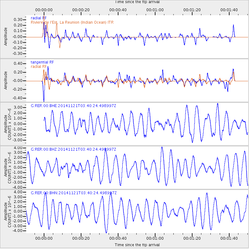
RER Riviere de l'Est, La Reunion (Indian Ocean) - Earthquake Result Viewer
*The percent match for this event was below the threshold and hence no stack was calculated.
| Earthquake location: |
Philippine Islands Region |
| Earthquake latitude/longitude: |
20.7/120.0 |
| Earthquake time(UTC): |
2014/11/21 (325) 03:29:12 GMT |
| Earthquake Depth: |
10 km |
| Earthquake Magnitude: |
5.9 MWP |
| Earthquake Catalog/Contributor: |
NEIC PDE/NEIC COMCAT |
|
| Network: |
G GEOSCOPE |
| Station: |
RER Riviere de l'Est, La Reunion (Indian Ocean) |
| Lat/Lon: |
21.16 S/55.75 E |
| Elevation: |
834 m |
|
| Distance: |
75.3 deg |
| Az: |
240.381 deg |
| Baz: |
60.702 deg |
| Ray Param: |
$rayparam |
*The percent match for this event was below the threshold and hence was not used in the summary stack. |
|
| Radial Match: |
44.930717 % |
| Radial Bump: |
400 |
| Transverse Match: |
66.46127 % |
| Transverse Bump: |
400 |
| SOD ConfigId: |
818962 |
| Insert Time: |
2014-12-05 03:44:39.371 +0000 |
| GWidth: |
2.5 |
| Max Bumps: |
400 |
| Tol: |
0.001 |
|
Signal To Noise
| Channel | StoN | STA | LTA |
| G:RER:00:BHZ:20141121T03:40:24.498997Z | 0.5263581 | 9.405621E-7 | 1.7869243E-6 |
| G:RER:00:BHN:20141121T03:40:24.498997Z | 2.331976 | 2.5204E-6 | 1.0808002E-6 |
| G:RER:00:BHE:20141121T03:40:24.498997Z | 0.9285655 | 1.1806166E-6 | 1.2714413E-6 |
| Arrivals |
| Ps | |
| PpPs | |
| PsPs/PpSs | |


