You are here: Home > Network List > TA - USArray Transportable Network (new EarthScope stations) Stations List
> Station O03E Paynes Creek, CA, USA > Earthquake Result Viewer
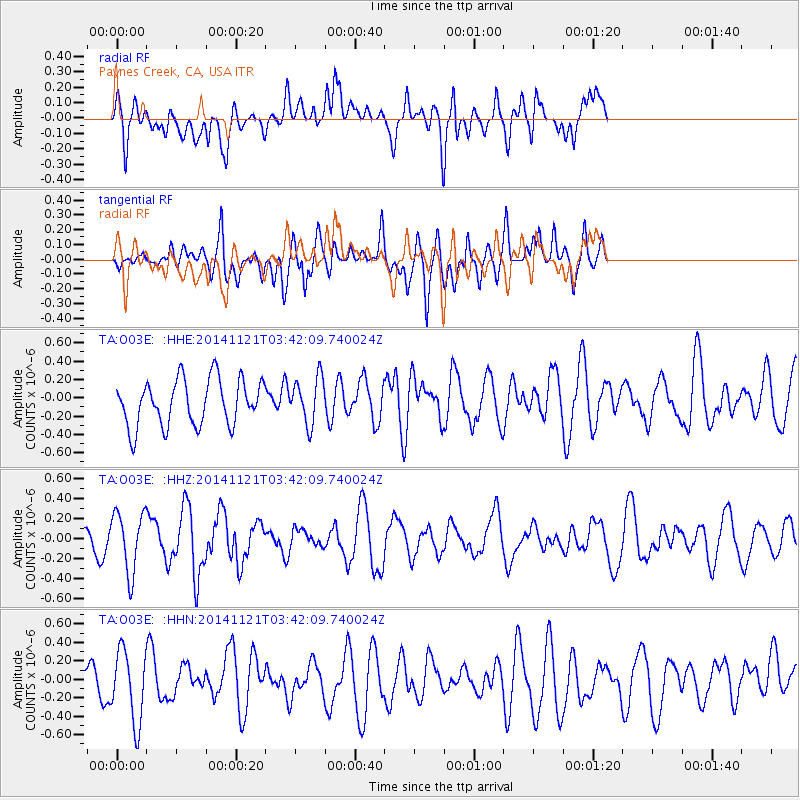
O03E Paynes Creek, CA, USA - Earthquake Result Viewer
*The percent match for this event was below the threshold and hence no stack was calculated.
| Earthquake location: |
Philippine Islands Region |
| Earthquake latitude/longitude: |
20.7/120.0 |
| Earthquake time(UTC): |
2014/11/21 (325) 03:29:12 GMT |
| Earthquake Depth: |
10 km |
| Earthquake Magnitude: |
5.9 MWP |
| Earthquake Catalog/Contributor: |
NEIC PDE/NEIC COMCAT |
|
| Network: |
TA USArray Transportable Network (new EarthScope stations) |
| Station: |
O03E Paynes Creek, CA, USA |
| Lat/Lon: |
40.29 N/121.80 W |
| Elevation: |
967 m |
|
| Distance: |
96.4 deg |
| Az: |
42.735 deg |
| Baz: |
303.824 deg |
| Ray Param: |
$rayparam |
*The percent match for this event was below the threshold and hence was not used in the summary stack. |
|
| Radial Match: |
38.034523 % |
| Radial Bump: |
400 |
| Transverse Match: |
53.40686 % |
| Transverse Bump: |
400 |
| SOD ConfigId: |
818962 |
| Insert Time: |
2014-12-05 03:53:26.161 +0000 |
| GWidth: |
2.5 |
| Max Bumps: |
400 |
| Tol: |
0.001 |
|
Signal To Noise
| Channel | StoN | STA | LTA |
| TA:O03E: :HHZ:20141121T03:42:09.740024Z | 1.9758176 | 3.0270172E-7 | 1.5320329E-7 |
| TA:O03E: :HHN:20141121T03:42:09.740024Z | 2.000826 | 3.990053E-7 | 1.994203E-7 |
| TA:O03E: :HHE:20141121T03:42:09.740024Z | 1.0124156 | 2.5416412E-7 | 2.5104723E-7 |
| Arrivals |
| Ps | |
| PpPs | |
| PsPs/PpSs | |


