You are here: Home > Network List > CN - Canadian National Seismograph Network Stations List
> Station INK INUVIK, NT > Earthquake Result Viewer
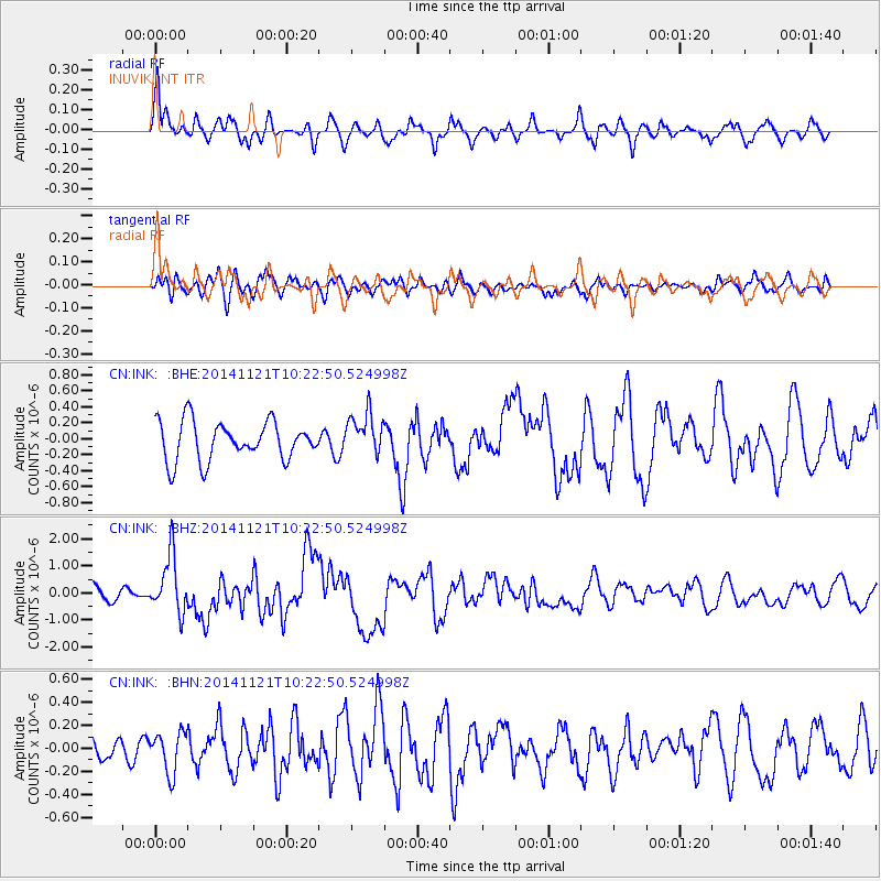
INK INUVIK, NT - Earthquake Result Viewer
*The percent match for this event was below the threshold and hence no stack was calculated.
| Earthquake location: |
Northern Molucca Sea |
| Earthquake latitude/longitude: |
2.3/127.1 |
| Earthquake time(UTC): |
2014/11/21 (325) 10:10:19 GMT |
| Earthquake Depth: |
38 km |
| Earthquake Magnitude: |
6.5 MWC, 6.8 MI, 6.9 MI |
| Earthquake Catalog/Contributor: |
NEIC PDE/NEIC COMCAT |
|
| Network: |
CN Canadian National Seismograph Network |
| Station: |
INK INUVIK, NT |
| Lat/Lon: |
68.31 N/133.53 W |
| Elevation: |
44 m |
|
| Distance: |
91.4 deg |
| Az: |
21.524 deg |
| Baz: |
279.586 deg |
| Ray Param: |
$rayparam |
*The percent match for this event was below the threshold and hence was not used in the summary stack. |
|
| Radial Match: |
72.49238 % |
| Radial Bump: |
363 |
| Transverse Match: |
60.39083 % |
| Transverse Bump: |
400 |
| SOD ConfigId: |
819163 |
| Insert Time: |
2014-12-05 10:19:07.717 +0000 |
| GWidth: |
2.5 |
| Max Bumps: |
400 |
| Tol: |
0.001 |
|
Signal To Noise
| Channel | StoN | STA | LTA |
| CN:INK: :BHZ:20141121T10:22:50.524998Z | 3.0726612 | 1.0661638E-6 | 3.4698385E-7 |
| CN:INK: :BHN:20141121T10:22:50.524998Z | 1.1488211 | 1.7828845E-7 | 1.5519252E-7 |
| CN:INK: :BHE:20141121T10:22:50.524998Z | 1.1040387 | 2.6590845E-7 | 2.4085065E-7 |
| Arrivals |
| Ps | |
| PpPs | |
| PsPs/PpSs | |


