You are here: Home > Network List > G - GEOSCOPE Stations List
> Station TAOE Taiohae, Marquises islands > Earthquake Result Viewer
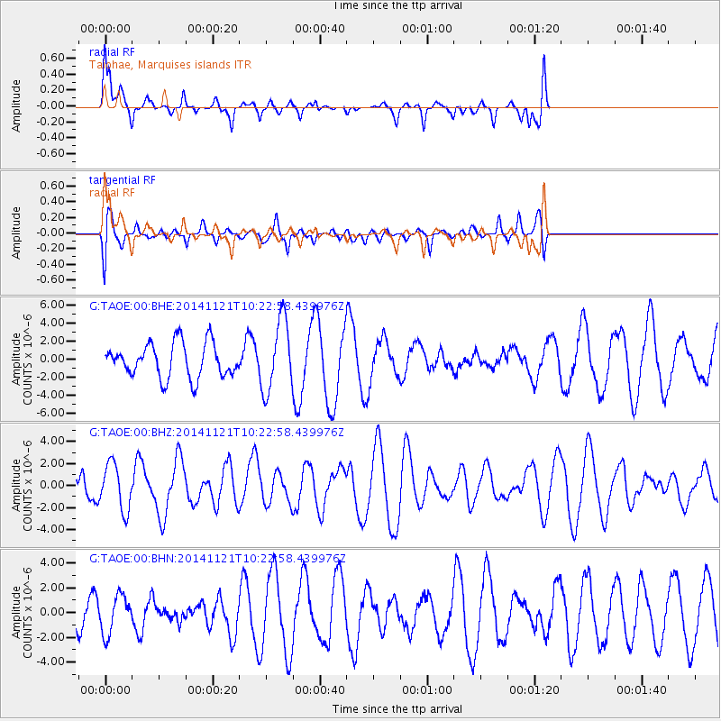
TAOE Taiohae, Marquises islands - Earthquake Result Viewer
*The percent match for this event was below the threshold and hence no stack was calculated.
| Earthquake location: |
Northern Molucca Sea |
| Earthquake latitude/longitude: |
2.3/127.1 |
| Earthquake time(UTC): |
2014/11/21 (325) 10:10:19 GMT |
| Earthquake Depth: |
38 km |
| Earthquake Magnitude: |
6.5 MWC, 6.8 MI, 6.9 MI |
| Earthquake Catalog/Contributor: |
NEIC PDE/NEIC COMCAT |
|
| Network: |
G GEOSCOPE |
| Station: |
TAOE Taiohae, Marquises islands |
| Lat/Lon: |
8.85 S/140.15 W |
| Elevation: |
800 m |
|
| Distance: |
93.1 deg |
| Az: |
98.692 deg |
| Baz: |
271.81 deg |
| Ray Param: |
$rayparam |
*The percent match for this event was below the threshold and hence was not used in the summary stack. |
|
| Radial Match: |
52.69509 % |
| Radial Bump: |
310 |
| Transverse Match: |
35.768158 % |
| Transverse Bump: |
390 |
| SOD ConfigId: |
819163 |
| Insert Time: |
2014-12-05 10:19:51.605 +0000 |
| GWidth: |
2.5 |
| Max Bumps: |
400 |
| Tol: |
0.001 |
|
Signal To Noise
| Channel | StoN | STA | LTA |
| G:TAOE:00:BHZ:20141121T10:22:58.439976Z | 1.0793861 | 2.1121014E-6 | 1.9567617E-6 |
| G:TAOE:00:BHN:20141121T10:22:58.439976Z | 0.5314579 | 1.5616358E-6 | 2.9384E-6 |
| G:TAOE:00:BHE:20141121T10:22:58.439976Z | 2.1066523 | 3.9859215E-6 | 1.8920642E-6 |
| Arrivals |
| Ps | |
| PpPs | |
| PsPs/PpSs | |


