You are here: Home > Network List > IU - Global Seismograph Network (GSN - IRIS/USGS) Stations List
> Station RSSD Black Hills, South Dakota, USA > Earthquake Result Viewer
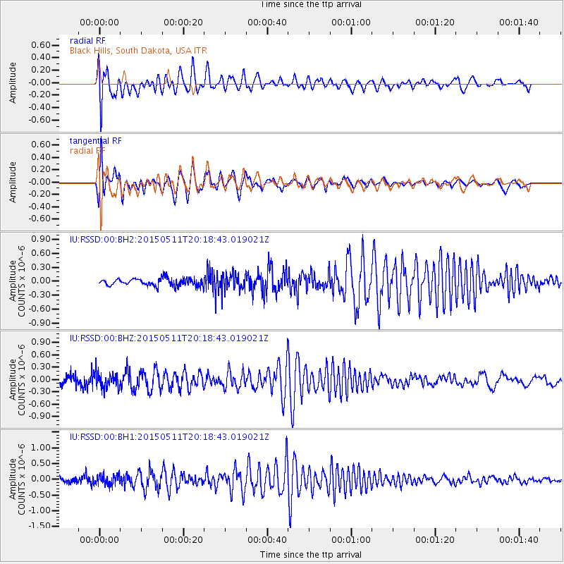
RSSD Black Hills, South Dakota, USA - Earthquake Result Viewer
*The percent match for this event was below the threshold and hence no stack was calculated.
| Earthquake location: |
Hokkaido, Japan Region |
| Earthquake latitude/longitude: |
42.4/142.9 |
| Earthquake time(UTC): |
2015/05/11 (131) 20:07:39 GMT |
| Earthquake Depth: |
73 km |
| Earthquake Magnitude: |
3.7 mb |
| Earthquake Catalog/Contributor: |
ISC/ISC |
|
| Network: |
IU Global Seismograph Network (GSN - IRIS/USGS) |
| Station: |
RSSD Black Hills, South Dakota, USA |
| Lat/Lon: |
44.12 N/104.04 W |
| Elevation: |
2090 m |
|
| Distance: |
75.1 deg |
| Az: |
43.29 deg |
| Baz: |
315.19 deg |
| Ray Param: |
$rayparam |
*The percent match for this event was below the threshold and hence was not used in the summary stack. |
|
| Radial Match: |
62.7338 % |
| Radial Bump: |
400 |
| Transverse Match: |
53.923264 % |
| Transverse Bump: |
400 |
| SOD ConfigId: |
7422571 |
| Insert Time: |
2019-04-18 19:57:39.534 +0000 |
| GWidth: |
2.5 |
| Max Bumps: |
400 |
| Tol: |
0.001 |
|
Signal To Noise
| Channel | StoN | STA | LTA |
| IU:RSSD:00:BHZ:20150511T20:18:43.019021Z | 2.0541925 | 1.8158202E-7 | 8.839581E-8 |
| IU:RSSD:00:BH1:20150511T20:18:43.019021Z | 2.3575745 | 1.6203074E-7 | 6.8727736E-8 |
| IU:RSSD:00:BH2:20150511T20:18:43.019021Z | 2.1446185 | 1.6748389E-7 | 7.8094956E-8 |
| Arrivals |
| Ps | |
| PpPs | |
| PsPs/PpSs | |


