You are here: Home > Network List > TA - USArray Transportable Network (new EarthScope stations) Stations List
> Station J01E Myrtle Point, OR, USA > Earthquake Result Viewer
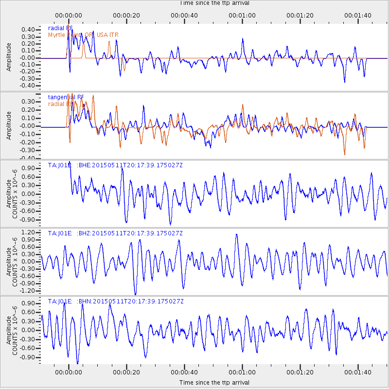
J01E Myrtle Point, OR, USA - Earthquake Result Viewer
*The percent match for this event was below the threshold and hence no stack was calculated.
| Earthquake location: |
Hokkaido, Japan Region |
| Earthquake latitude/longitude: |
42.4/142.9 |
| Earthquake time(UTC): |
2015/05/11 (131) 20:07:39 GMT |
| Earthquake Depth: |
73 km |
| Earthquake Magnitude: |
3.7 mb |
| Earthquake Catalog/Contributor: |
ISC/ISC |
|
| Network: |
TA USArray Transportable Network (new EarthScope stations) |
| Station: |
J01E Myrtle Point, OR, USA |
| Lat/Lon: |
43.16 N/123.93 W |
| Elevation: |
128 m |
|
| Distance: |
64.6 deg |
| Az: |
53.947 deg |
| Baz: |
305.128 deg |
| Ray Param: |
$rayparam |
*The percent match for this event was below the threshold and hence was not used in the summary stack. |
|
| Radial Match: |
46.850723 % |
| Radial Bump: |
400 |
| Transverse Match: |
49.32012 % |
| Transverse Bump: |
400 |
| SOD ConfigId: |
7422571 |
| Insert Time: |
2019-04-18 20:00:04.360 +0000 |
| GWidth: |
2.5 |
| Max Bumps: |
400 |
| Tol: |
0.001 |
|
Signal To Noise
| Channel | StoN | STA | LTA |
| TA:J01E: :BHZ:20150511T20:17:39.175027Z | 0.9718742 | 3.320446E-7 | 3.416539E-7 |
| TA:J01E: :BHN:20150511T20:17:39.175027Z | 1.6826509 | 5.703198E-7 | 3.3894125E-7 |
| TA:J01E: :BHE:20150511T20:17:39.175027Z | 1.0384904 | 3.840855E-7 | 3.6984983E-7 |
| Arrivals |
| Ps | |
| PpPs | |
| PsPs/PpSs | |


