You are here: Home > Network List > TA - USArray Transportable Network (new EarthScope stations) Stations List
> Station P56A Dayton Farm, Ripley, WV, USA > Earthquake Result Viewer
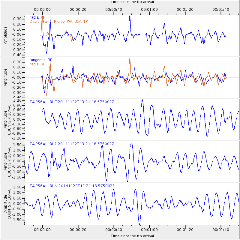
P56A Dayton Farm, Ripley, WV, USA - Earthquake Result Viewer
*The percent match for this event was below the threshold and hence no stack was calculated.
| Earthquake location: |
Eastern Honshu, Japan |
| Earthquake latitude/longitude: |
36.6/137.9 |
| Earthquake time(UTC): |
2014/11/22 (326) 13:08:18 GMT |
| Earthquake Depth: |
10 km |
| Earthquake Magnitude: |
6.2 MWP |
| Earthquake Catalog/Contributor: |
NEIC PDE/NEIC COMCAT |
|
| Network: |
TA USArray Transportable Network (new EarthScope stations) |
| Station: |
P56A Dayton Farm, Ripley, WV, USA |
| Lat/Lon: |
39.50 N/78.84 W |
| Elevation: |
249 m |
|
| Distance: |
97.0 deg |
| Az: |
27.8 deg |
| Baz: |
330.996 deg |
| Ray Param: |
$rayparam |
*The percent match for this event was below the threshold and hence was not used in the summary stack. |
|
| Radial Match: |
65.111946 % |
| Radial Bump: |
400 |
| Transverse Match: |
61.86311 % |
| Transverse Bump: |
400 |
| SOD ConfigId: |
819644 |
| Insert Time: |
2014-12-06 13:46:46.703 +0000 |
| GWidth: |
2.5 |
| Max Bumps: |
400 |
| Tol: |
0.001 |
|
Signal To Noise
| Channel | StoN | STA | LTA |
| TA:P56A: :BHZ:20141122T13:21:18.575002Z | 1.3196354 | 7.1519884E-7 | 5.41967E-7 |
| TA:P56A: :BHN:20141122T13:21:18.575002Z | 2.1825743 | 7.0424994E-7 | 3.2266942E-7 |
| TA:P56A: :BHE:20141122T13:21:18.575002Z | 0.9379524 | 3.710962E-7 | 3.9564503E-7 |
| Arrivals |
| Ps | |
| PpPs | |
| PsPs/PpSs | |


